1957
Tropical Depression NOT_NAMED (1957072S20051)
IBTrACS version v04r00. Visit
IBTrACS website for data access.
Please direct all questions to the
IBTrACS Q and A forum
Storm track
-
Intensity
-
Wind Radii
-
Intensity Data
-
Source Data
-
All data
Summary Information
|
|
| Storm ID |
1957072S20051 |
| Start |
Mar 13 06Z |
| Max Intensity |
25 kt (Mar 13 09Z) |
| End |
Mar 14 09Z |
| ATCF IDs |
SH261957 |
| Track status |
Best track data. |
|
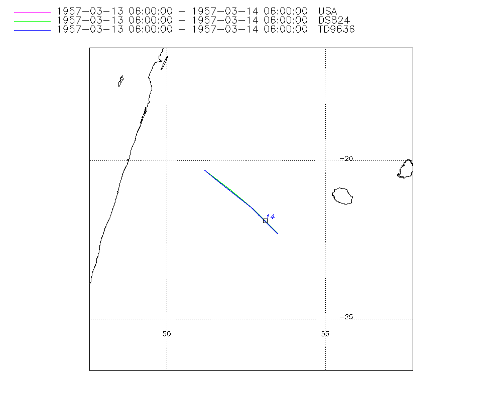
Storm track plot
|
Intensity plots

|
Radial wind information
No radial wind information for this storm
|
Position and Intensity Table
| BASIN |
ISO_TIME_________ |
NATURE |
LAT |
LON |
DS824 WIND |
| |
|
|
degrees north |
degrees east |
kts |
| SI |
1957-03-13 06:00:00 |
TS |
-20.30 |
51.20 |
25 |
| SI |
09:00:00 |
TS |
-20.62 |
51.61 |
25 |
| SI |
12:00:00 |
TS |
-20.93 |
52.01 |
25 |
| SI |
15:00:00 |
TS |
-21.24 |
52.39 |
25 |
| SI |
18:00:00 |
TS |
-21.50 |
52.70 |
25 |
| SI |
21:00:00 |
TS |
-21.69 |
52.92 |
25 |
| SI |
1957-03-14 00:00:00 |
TS |
-21.87 |
53.09 |
25 |
| SI |
03:00:00 |
TS |
-22.02 |
53.26 |
25 |
| SI |
06:00:00 |
TS |
-22.30 |
53.50 |
25 |
| SI |
09:00:00 |
TS |
-22.88 |
53.91 |
|
Source Information
| Agency |
Information |
| USA |
bsh261957.txt |
| TOKYO |
|
| CMA |
|
| HKO |
|
| NEWDELHI |
|
| REUNION |
|
| BOM |
|
| NADI |
|
| WELLINGTON |
|
| DS824 |
s_hem.dat:711:26S |
| TD9636 |
cons_worldwide_trop_cyclone_18710101-19891231-005:Line=7453 |
| TD9635 |
|
| NEUMANN |
|
| MLC |
|
All available IBTrACS Data
| SEASON |
BASIN |
SUBBASIN |
ISO_TIME_________ |
NATURE |
LAT |
LON |
DIST2LAND |
LANDFALL |
IFLAG |
USA AGENCY |
USA ATCF_ID |
USA LAT |
USA LON |
USA SSHS |
DS824 LAT |
DS824 LON |
DS824 STAGE |
DS824 WIND |
TD9636 LAT |
TD9636 LON |
TD9636 STAGE |
STORM SPEED |
STORM DIR |
| Year |
|
|
|
|
degrees north |
degrees east |
km |
km |
|
|
|
degrees north |
degrees east |
1 |
degrees north |
degrees east |
|
kts |
degrees north |
degrees east |
|
kts |
degrees |
| 1957 |
SI |
MM |
1957-03-13 06:00:00 |
TS |
-20.30 |
51.20 |
252 |
252 |
O________OO___ |
jtwc_sh |
SH261957 |
-20.30 |
51.20 |
-5 |
-20.30 |
51.20 |
TC |
25 |
-20.30 |
51.20 |
7 |
10 |
129 |
| 1957 |
SI |
MM |
09:00:00 |
TS |
-20.62 |
51.61 |
299 |
299 |
P________PP___ |
|
SH261957 |
-20.60 |
51.60 |
-5 |
-20.60 |
51.60 |
TC |
25 |
-20.60 |
51.57 |
7 |
10 |
130 |
| 1957 |
SI |
MM |
12:00:00 |
TS |
-20.93 |
52.01 |
332 |
290 |
O________OP___ |
jtwc_sh |
SH261957 |
-20.90 |
52.00 |
-5 |
-20.90 |
52.00 |
TC |
25 |
-20.90 |
51.95 |
7 |
10 |
131 |
| 1957 |
SI |
MM |
15:00:00 |
TS |
-21.24 |
52.39 |
290 |
262 |
P________PP___ |
|
SH261957 |
-21.21 |
52.38 |
-5 |
-21.21 |
52.38 |
TC |
25 |
-21.20 |
52.32 |
7 |
9 |
132 |
| 1957 |
SI |
MM |
18:00:00 |
TS |
-21.50 |
52.70 |
262 |
244 |
O________OO___ |
jtwc_sh |
SH261957 |
-21.50 |
52.70 |
-5 |
-21.50 |
52.70 |
TC |
25 |
-21.50 |
52.70 |
1 |
7 |
133 |
| 1957 |
SI |
MM |
21:00:00 |
TS |
-21.69 |
52.92 |
247 |
230 |
P________PP___ |
|
SH261957 |
-21.71 |
52.92 |
-5 |
-21.71 |
52.92 |
TC |
25 |
-21.70 |
52.90 |
1 |
5 |
135 |
| 1957 |
SI |
MM |
1957-03-14 00:00:00 |
TS |
-21.87 |
53.09 |
234 |
220 |
O________OP___ |
jtwc_sh |
SH261957 |
-21.90 |
53.10 |
-5 |
-21.90 |
53.10 |
TC |
25 |
-21.90 |
53.10 |
1 |
5 |
135 |
| 1957 |
SI |
MM |
03:00:00 |
TS |
-22.02 |
53.26 |
220 |
215 |
P________PP___ |
|
SH261957 |
-22.10 |
53.29 |
-5 |
-22.10 |
53.29 |
TC |
25 |
-22.10 |
53.30 |
1 |
6 |
139 |
| 1957 |
SI |
MM |
06:00:00 |
TS |
-22.30 |
53.50 |
216 |
212 |
O________OO___ |
jtwc_sh |
SH261957 |
-22.30 |
53.50 |
-5 |
-22.30 |
53.50 |
TC |
25 |
-22.30 |
53.50 |
1 |
11 |
145 |
| 1957 |
SI |
MM |
09:00:00 |
TS |
-22.88 |
53.91 |
229 |
|
______________ |
|
SH261957 |
|
|
-5 |
|
|
TC |
|
|
|
1 |
14 |
147 |