1995
Tropical Depression HELEN (1995220N14131)
IBTrACS version v04r00. Visit
IBTrACS website for data access.
Please direct all questions to the
IBTrACS Q and A forum
Storm track
-
Intensity
-
Wind Radii
-
Intensity Data
-
Source Data
-
All data
Summary Information
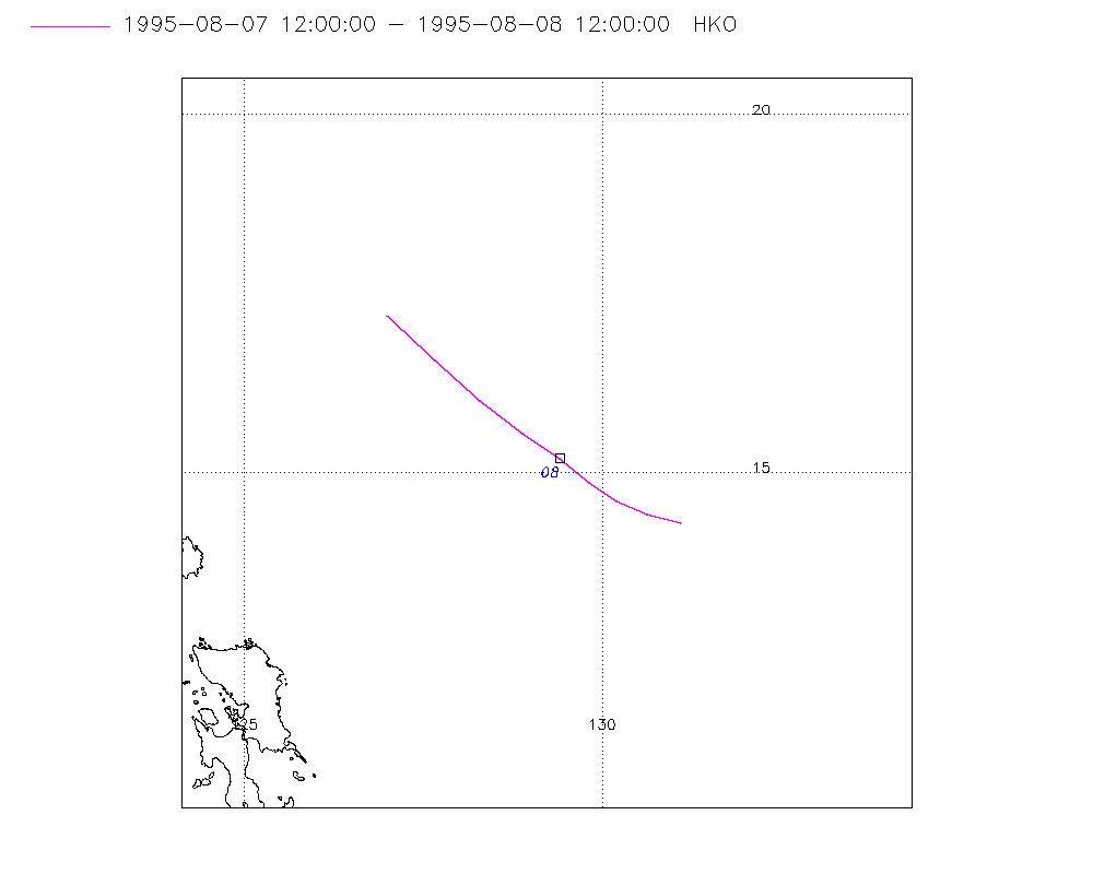
Storm track plot
|
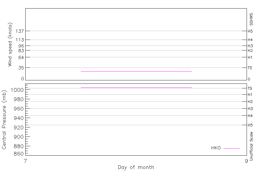
Intensity plots
|
Radial wind information
No radial wind information for this storm
|
Position and Intensity Table
Source Information
| Agency |
Information |
| USA |
|
| TOKYO |
|
| CMA |
|
| HKO |
tc-besttrack-data-current.txt:Line=24978:HELEN |
| NEWDELHI |
|
| REUNION |
|
| BOM |
|
| NADI |
|
| WELLINGTON |
|
| DS824 |
|
| TD9636 |
|
| TD9635 |
|
| NEUMANN |
|
| MLC |
|
All available IBTrACS Data
| SEASON |
BASIN |
SUBBASIN |
ISO_TIME_________ |
NATURE |
LAT |
LON |
DIST2LAND |
LANDFALL |
IFLAG |
USA SSHS |
HKO LAT |
HKO LON |
HKO CAT |
HKO WIND |
HKO PRES |
STORM SPEED |
STORM DIR |
| Year |
|
|
|
|
degrees north |
degrees east |
km |
km |
|
1 |
degrees north |
degrees east |
|
kts |
mb |
kts |
degrees |
| 1995 |
WP |
MM |
1995-08-07 12:00:00 |
NR |
14.30 |
131.10 |
650 |
614 |
___O__________ |
-5 |
14.30 |
131.10 |
TD |
25 |
1005 |
9 |
283 |
| 1995 |
WP |
MM |
15:00:00 |
NR |
14.40 |
130.64 |
604 |
575 |
___P__________ |
-5 |
14.43 |
130.63 |
TD |
25 |
1005 |
9 |
289 |
| 1995 |
WP |
MM |
18:00:00 |
NR |
14.60 |
130.20 |
575 |
548 |
___O__________ |
-5 |
14.60 |
130.20 |
TD |
25 |
1005 |
9 |
300 |
| 1995 |
WP |
MM |
21:00:00 |
NR |
14.86 |
129.81 |
554 |
538 |
___P__________ |
-5 |
14.86 |
129.81 |
TD |
25 |
1005 |
10 |
308 |
| 1995 |
WP |
MM |
1995-08-08 00:00:00 |
NR |
15.20 |
129.40 |
538 |
516 |
___O__________ |
-5 |
15.20 |
129.40 |
TD |
25 |
1005 |
11 |
308 |
| 1995 |
WP |
MM |
03:00:00 |
NR |
15.55 |
128.89 |
520 |
480 |
___P__________ |
-5 |
15.55 |
128.89 |
TD |
25 |
1005 |
13 |
307 |
| 1995 |
WP |
MM |
06:00:00 |
NR |
16.00 |
128.30 |
480 |
458 |
___O__________ |
-5 |
16.00 |
128.30 |
TD |
25 |
1005 |
16 |
311 |
| 1995 |
WP |
MM |
09:00:00 |
NR |
16.57 |
127.67 |
465 |
456 |
___P__________ |
-5 |
16.57 |
127.66 |
TD |
25 |
1005 |
17 |
314 |
| 1995 |
WP |
MM |
12:00:00 |
NR |
17.20 |
127.00 |
460 |
|
___O__________ |
-5 |
17.20 |
127.00 |
TD |
25 |
1005 |
18 |
314 |