1982
Moderate Tropical Storm NOT_NAMED (1982054S23036)
IBTrACS version v04r00. Visit
IBTrACS website for data access.
Please direct all questions to the
IBTrACS Q and A forum
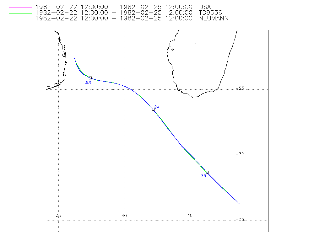
Storm track
-
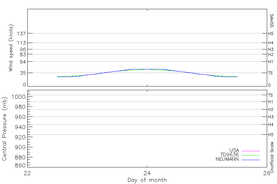
Intensity
-
Wind Radii
-
Intensity Data
-
Source Data
-
All data
Summary Information
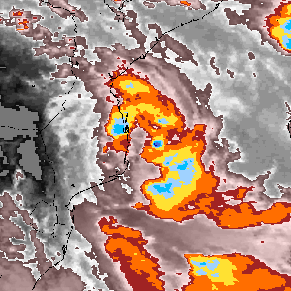
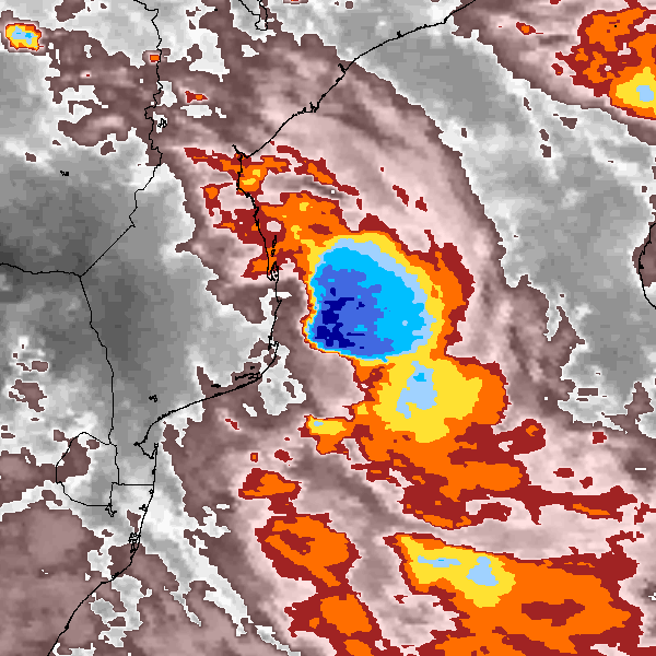
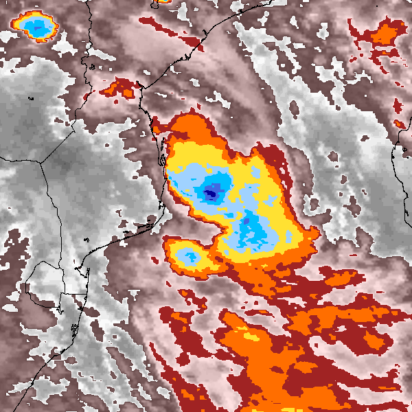
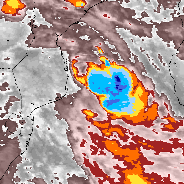
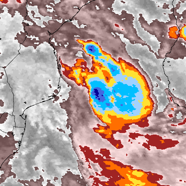
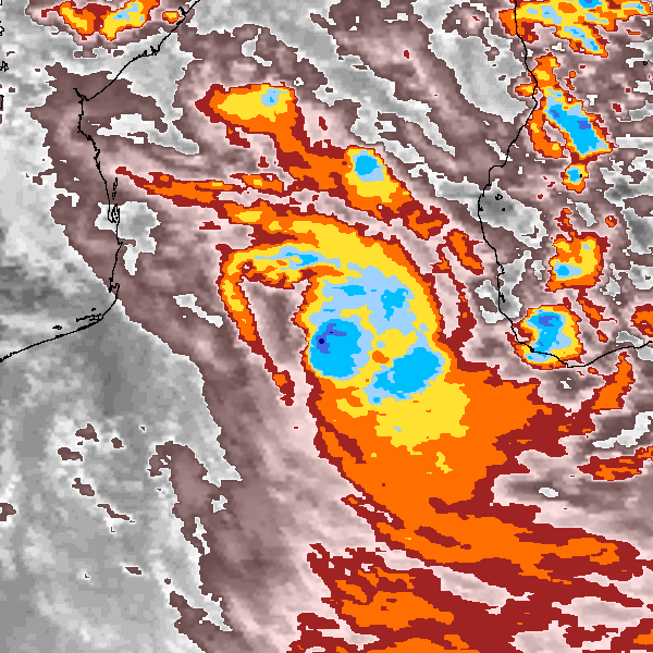
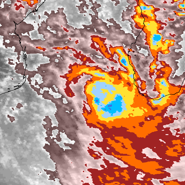
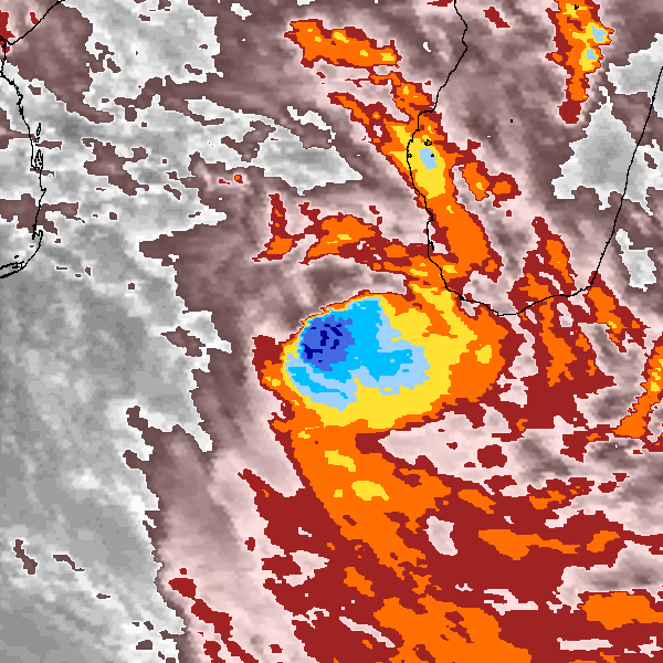
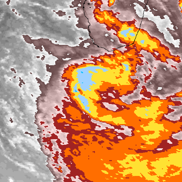
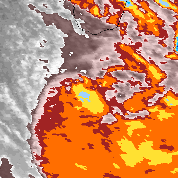
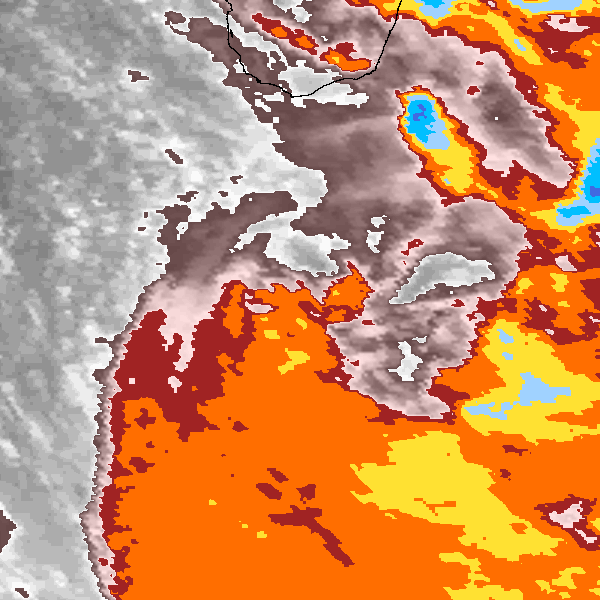
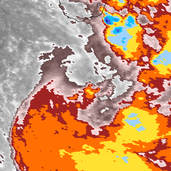
Storm track plot
|
Intensity plots
|
Radial wind information
No radial wind information for this storm
|
Position and Intensity Table
| BASIN |
ISO_TIME_________ |
NATURE |
LAT |
LON |
USA WIND |
TD9636 WIND |
NEUMANN WIND |
| |
|
|
degrees north |
degrees east |
kts |
kts |
kts |
| SI |
1982-02-22 12:00:00 |
TS |
-22.60 |
36.20 |
25 |
25 |
25 |
| SI |
15:00:00 |
TS |
-23.06 |
36.38 |
25 |
26 |
25 |
| SI |
18:00:00 |
TS |
-23.49 |
36.62 |
25 |
27 |
25 |
| SI |
21:00:00 |
TS |
-23.84 |
36.94 |
27 |
28 |
27 |
| SI |
1982-02-23 00:00:00 |
TS |
-24.10 |
37.40 |
30 |
30 |
30 |
| SI |
03:00:00 |
TS |
-24.27 |
38.00 |
32 |
32 |
32 |
| SI |
06:00:00 |
TS |
-24.39 |
38.68 |
35 |
35 |
35 |
| SI |
09:00:00 |
TS |
-24.51 |
39.35 |
37 |
37 |
37 |
| SI |
12:00:00 |
TS |
-24.70 |
40.00 |
40 |
40 |
40 |
| SI |
15:00:00 |
TS |
-25.00 |
40.57 |
42 |
41 |
42 |
| SI |
18:00:00 |
TS |
-25.41 |
41.11 |
45 |
42 |
45 |
| SI |
21:00:00 |
TS |
-25.91 |
41.66 |
45 |
43 |
45 |
| SI |
1982-02-24 00:00:00 |
TS |
-26.50 |
42.20 |
45 |
45 |
45 |
| SI |
03:00:00 |
TS |
-27.17 |
42.75 |
45 |
43 |
45 |
| SI |
06:00:00 |
TS |
-27.89 |
43.31 |
45 |
42 |
45 |
| SI |
09:00:00 |
TS |
-28.63 |
43.86 |
42 |
41 |
42 |
| SI |
12:00:00 |
TS |
-29.30 |
44.40 |
40 |
40 |
40 |
| SI |
15:00:00 |
TS |
-29.83 |
44.90 |
37 |
37 |
37 |
| SI |
18:00:00 |
TS |
-30.31 |
45.38 |
35 |
35 |
35 |
| SI |
21:00:00 |
TS |
-30.79 |
45.82 |
32 |
32 |
32 |
| SI |
1982-02-25 00:00:00 |
TS |
-31.30 |
46.30 |
30 |
30 |
30 |
| SI |
03:00:00 |
TS |
-31.87 |
46.87 |
27 |
28 |
27 |
| SI |
06:00:00 |
TS |
-32.48 |
47.49 |
25 |
27 |
25 |
| SI |
09:00:00 |
TS |
-33.09 |
48.14 |
25 |
26 |
25 |
| SI |
12:00:00 |
TS |
-33.70 |
48.80 |
25 |
25 |
25 |
Source Information
| Agency |
Information |
| USA |
bsh201982.txt |
| TOKYO |
|
| CMA |
|
| HKO |
|
| NEWDELHI |
|
| REUNION |
|
| BOM |
|
| NADI |
|
| WELLINGTON |
|
| DS824 |
|
| TD9636 |
cons_worldwide_trop_cyclone_18710101-19891231-005:Line=12279 |
| TD9635 |
|
| NEUMANN |
tracks.sh:Storm=645:HSK2482:BSH1882:JTWC |
| MLC |
|
All available IBTrACS Data
| SEASON |
BASIN |
SUBBASIN |
ISO_TIME_________ |
NATURE |
LAT |
LON |
DIST2LAND |
LANDFALL |
IFLAG |
USA AGENCY |
USA ATCF_ID |
USA LAT |
USA LON |
USA WIND |
USA SSHS |
TD9636 LAT |
TD9636 LON |
TD9636 STAGE |
TD9636 WIND |
NEUMANN LAT |
NEUMANN LON |
NEUMANN CLASS |
NEUMANN WIND |
STORM SPEED |
STORM DIR |
| Year |
|
|
|
|
degrees north |
degrees east |
km |
km |
|
|
|
degrees north |
degrees east |
kts |
1 |
degrees north |
degrees east |
|
kts |
degrees north |
degrees east |
|
kts |
kts |
degrees |
| 1982 |
SI |
MM |
1982-02-22 12:00:00 |
TS |
-22.60 |
36.20 |
70 |
65 |
O_________O_O_ |
jtwc_sh |
SH201982 |
-22.60 |
36.20 |
25 |
-1 |
-22.60 |
36.20 |
1 |
25 |
-22.60 |
36.20 |
TC |
25 |
10 |
160 |
| 1982 |
SI |
MM |
15:00:00 |
TS |
-23.06 |
36.38 |
84 |
84 |
P_________P_P_ |
|
SH201982 |
-23.07 |
36.37 |
25 |
-1 |
-23.05 |
36.40 |
1 |
26 |
-23.07 |
36.37 |
TC |
25 |
10 |
157 |
| 1982 |
SI |
MM |
18:00:00 |
TS |
-23.49 |
36.62 |
117 |
117 |
O_________P_O_ |
jtwc_sh |
SH201982 |
-23.50 |
36.60 |
25 |
-1 |
-23.47 |
36.65 |
1 |
27 |
-23.50 |
36.60 |
TC |
25 |
9 |
146 |
| 1982 |
SI |
MM |
21:00:00 |
TS |
-23.84 |
36.94 |
142 |
142 |
P_________P_P_ |
|
SH201982 |
-23.84 |
36.93 |
27 |
-1 |
-23.83 |
36.97 |
1 |
28 |
-23.84 |
36.93 |
TC |
27 |
9 |
130 |
| 1982 |
SI |
MM |
1982-02-23 00:00:00 |
TS |
-24.10 |
37.40 |
192 |
192 |
O_________O_O_ |
jtwc_sh |
SH201982 |
-24.10 |
37.40 |
30 |
-1 |
-24.10 |
37.40 |
1 |
30 |
-24.10 |
37.40 |
TC |
30 |
11 |
114 |
| 1982 |
SI |
MM |
03:00:00 |
TS |
-24.27 |
38.00 |
254 |
254 |
P_________P_P_ |
|
SH201982 |
-24.27 |
38.01 |
32 |
-1 |
-24.27 |
37.97 |
1 |
32 |
-24.27 |
38.01 |
TC |
32 |
12 |
104 |
| 1982 |
SI |
MM |
06:00:00 |
TS |
-24.39 |
38.68 |
325 |
325 |
O_________P_O_ |
jtwc_sh |
SH201982 |
-24.40 |
38.70 |
35 |
0 |
-24.38 |
38.63 |
1 |
35 |
-24.40 |
38.70 |
TC |
35 |
13 |
101 |
| 1982 |
SI |
MM |
09:00:00 |
TS |
-24.51 |
39.35 |
397 |
380 |
P_________P_P_ |
|
SH201982 |
-24.52 |
39.37 |
37 |
0 |
-24.50 |
39.32 |
1 |
37 |
-24.52 |
39.37 |
TC |
37 |
12 |
104 |
| 1982 |
SI |
MM |
12:00:00 |
TS |
-24.70 |
40.00 |
380 |
334 |
O_________O_O_ |
jtwc_sh |
SH201982 |
-24.70 |
40.00 |
40 |
0 |
-24.70 |
40.00 |
2 |
40 |
-24.70 |
40.00 |
TC |
40 |
12 |
114 |
| 1982 |
SI |
MM |
15:00:00 |
TS |
-25.00 |
40.57 |
325 |
286 |
P_________P_P_ |
|
SH201982 |
-24.99 |
40.57 |
42 |
0 |
-25.02 |
40.58 |
2 |
41 |
-24.99 |
40.57 |
TC |
42 |
12 |
125 |
| 1982 |
SI |
MM |
18:00:00 |
TS |
-25.41 |
41.11 |
286 |
256 |
O_________P_O_ |
jtwc_sh |
SH201982 |
-25.40 |
41.10 |
45 |
0 |
-25.43 |
41.13 |
2 |
42 |
-25.40 |
41.10 |
TC |
45 |
13 |
133 |
| 1982 |
SI |
MM |
21:00:00 |
TS |
-25.91 |
41.66 |
251 |
241 |
P_________P_P_ |
|
SH201982 |
-25.90 |
41.65 |
45 |
0 |
-25.93 |
41.67 |
2 |
43 |
-25.90 |
41.65 |
TC |
45 |
15 |
138 |
| 1982 |
SI |
MM |
1982-02-24 00:00:00 |
TS |
-26.50 |
42.20 |
246 |
246 |
O_________O_O_ |
jtwc_sh |
SH201982 |
-26.50 |
42.20 |
45 |
0 |
-26.50 |
42.20 |
2 |
45 |
-26.50 |
42.20 |
TC |
45 |
16 |
142 |
| 1982 |
SI |
MM |
03:00:00 |
TS |
-27.17 |
42.75 |
265 |
265 |
P_________P_P_ |
|
SH201982 |
-27.18 |
42.75 |
45 |
0 |
-27.16 |
42.76 |
2 |
43 |
-27.18 |
42.75 |
TC |
45 |
17 |
145 |
| 1982 |
SI |
MM |
06:00:00 |
TS |
-27.89 |
43.31 |
310 |
310 |
O_________P_O_ |
jtwc_sh |
SH201982 |
-27.90 |
43.30 |
45 |
0 |
-27.88 |
43.32 |
2 |
42 |
-27.90 |
43.30 |
TC |
45 |
18 |
146 |
| 1982 |
SI |
MM |
09:00:00 |
TS |
-28.63 |
43.86 |
358 |
358 |
P_________P_P_ |
|
SH201982 |
-28.63 |
43.86 |
42 |
0 |
-28.62 |
43.87 |
2 |
41 |
-28.63 |
43.86 |
TC |
42 |
17 |
146 |
| 1982 |
SI |
MM |
12:00:00 |
TS |
-29.30 |
44.40 |
420 |
420 |
O_________O_O_ |
jtwc_sh |
SH201982 |
-29.30 |
44.40 |
40 |
0 |
-29.30 |
44.40 |
2 |
40 |
-29.30 |
44.40 |
TC |
40 |
15 |
143 |
| 1982 |
SI |
MM |
15:00:00 |
TS |
-29.83 |
44.90 |
469 |
469 |
P_________P_P_ |
|
SH201982 |
-29.83 |
44.92 |
37 |
0 |
-29.84 |
44.88 |
2 |
37 |
-29.83 |
44.92 |
TC |
37 |
13 |
140 |
| 1982 |
SI |
MM |
18:00:00 |
TS |
-30.31 |
45.38 |
524 |
524 |
O_________P_O_ |
jtwc_sh |
SH201982 |
-30.30 |
45.40 |
35 |
0 |
-30.33 |
45.33 |
2 |
35 |
-30.30 |
45.40 |
TC |
35 |
12 |
140 |
| 1982 |
SI |
MM |
21:00:00 |
TS |
-30.79 |
45.82 |
581 |
581 |
P_________P_P_ |
|
SH201982 |
-30.78 |
45.84 |
32 |
-1 |
-30.80 |
45.80 |
2 |
32 |
-30.78 |
45.84 |
TC |
32 |
13 |
141 |
| 1982 |
SI |
MM |
1982-02-25 00:00:00 |
TS |
-31.30 |
46.30 |
641 |
641 |
O_________O_O_ |
jtwc_sh |
SH201982 |
-31.30 |
46.30 |
30 |
-1 |
-31.30 |
46.30 |
1 |
30 |
-31.30 |
46.30 |
TC |
30 |
14 |
141 |
| 1982 |
SI |
MM |
03:00:00 |
TS |
-31.87 |
46.87 |
716 |
716 |
P_________P_P_ |
|
SH201982 |
-31.88 |
46.87 |
27 |
-1 |
-31.85 |
46.86 |
1 |
28 |
-31.88 |
46.87 |
TC |
27 |
16 |
139 |
| 1982 |
SI |
MM |
06:00:00 |
TS |
-32.48 |
47.49 |
794 |
794 |
O_________P_O_ |
jtwc_sh |
SH201982 |
-32.50 |
47.50 |
25 |
-1 |
-32.44 |
47.47 |
1 |
27 |
-32.50 |
47.50 |
TC |
25 |
16 |
139 |
| 1982 |
SI |
MM |
09:00:00 |
TS |
-33.09 |
48.14 |
874 |
874 |
P_________P_P_ |
|
SH201982 |
-33.11 |
48.15 |
25 |
-1 |
-33.07 |
48.12 |
1 |
26 |
-33.11 |
48.15 |
TC |
25 |
16 |
138 |
| 1982 |
SI |
MM |
12:00:00 |
TS |
-33.70 |
48.80 |
958 |
|
O_________O_O_ |
jtwc_sh |
SH201982 |
-33.70 |
48.80 |
25 |
-1 |
-33.70 |
48.80 |
1 |
25 |
-33.70 |
48.80 |
TC |
25 |
16 |
138 |