1979
Moderate Tropical Storm NOT_NAMED (1979096S11074)
IBTrACS version v04r00. Visit
IBTrACS website for data access.
Please direct all questions to the
IBTrACS Q and A forum
Storm track
-
Intensity
-
Wind Radii
-
Intensity Data
-
Source Data
-
All data
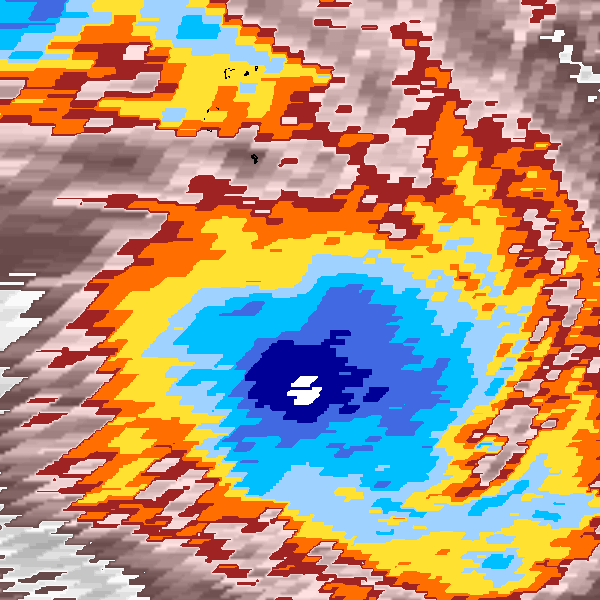
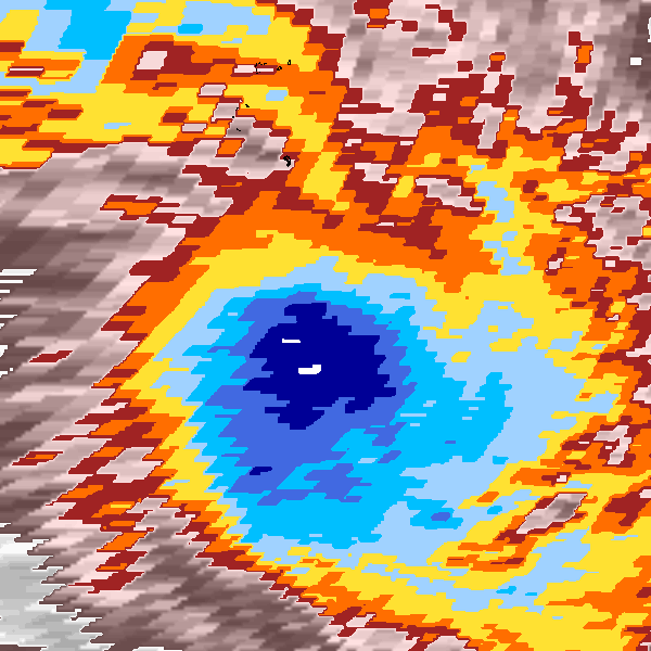
Summary Information
|
| Storm ID |
1979096S11074 |
| Start |
Apr 6 06Z |
| Max Intensity |
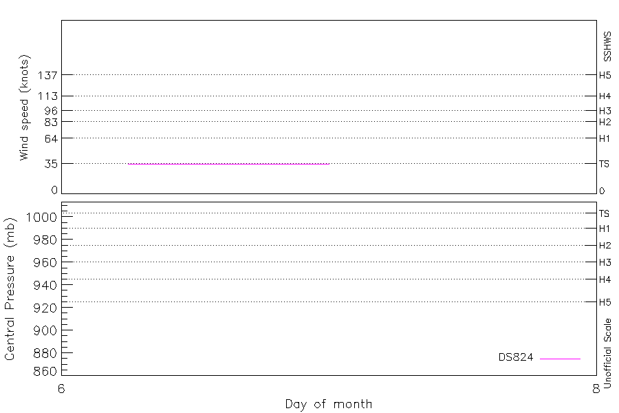
35 kt (Apr 6 09Z) |
| End |
Apr 7 03Z |
| ATCF IDs |
SH251979 |
| Track status |
Best track data. |
|
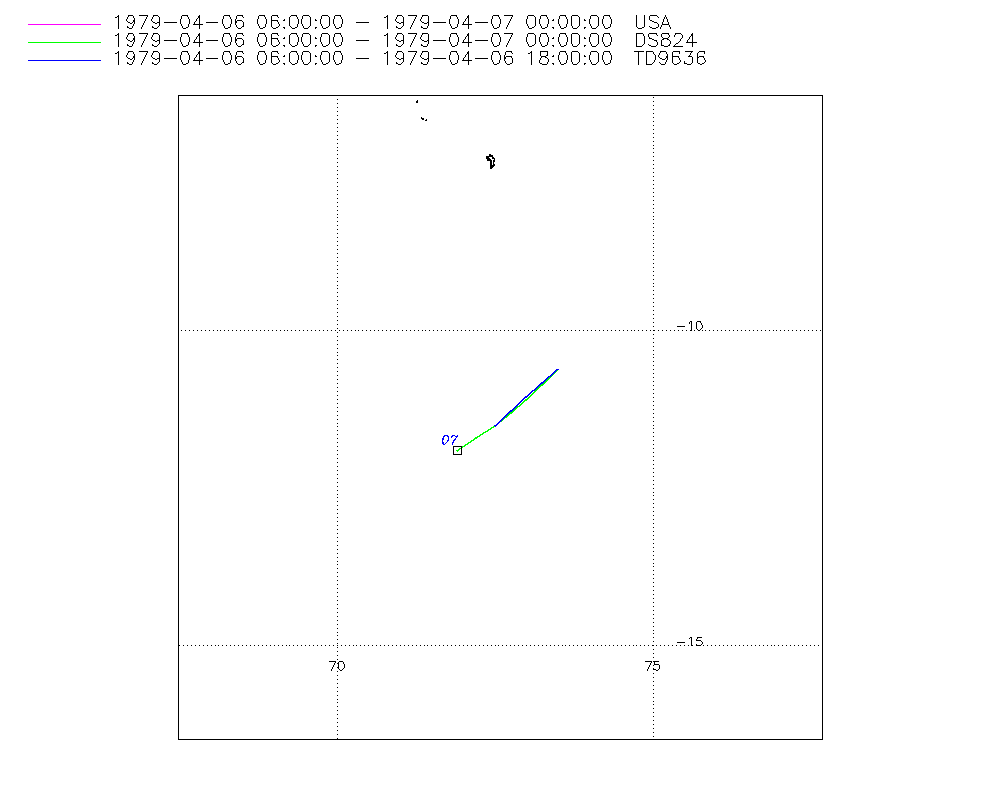
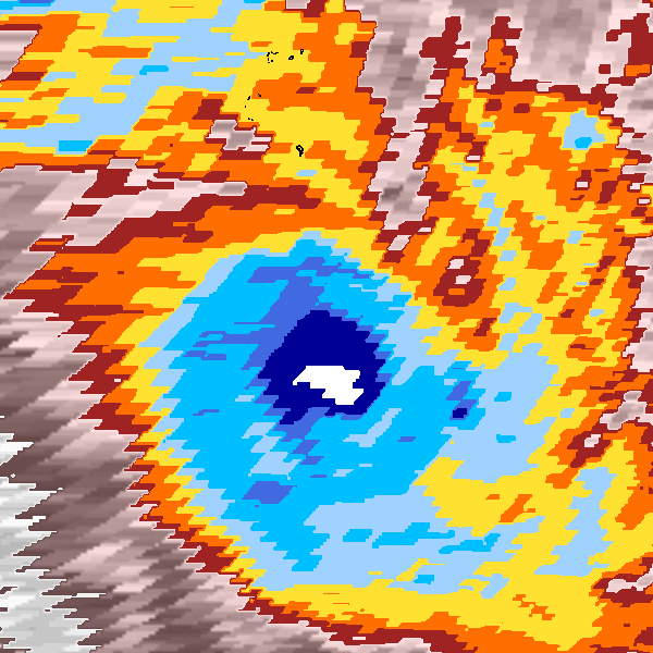
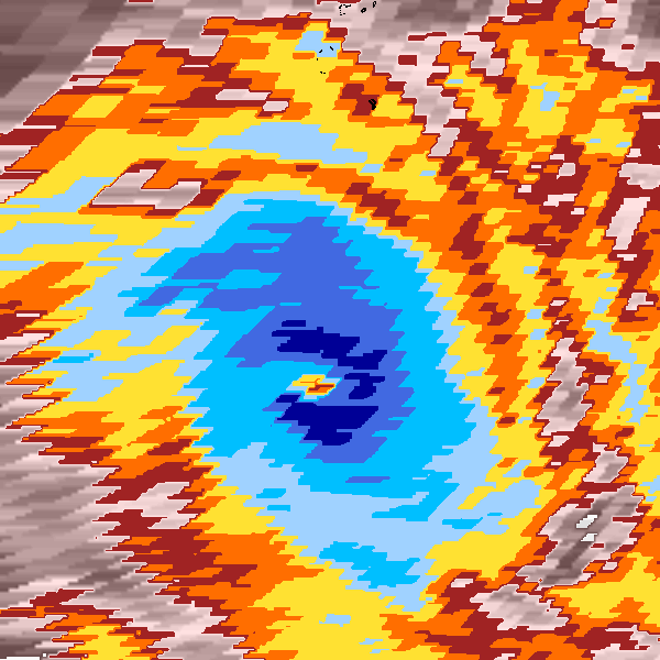
Storm track plot
|
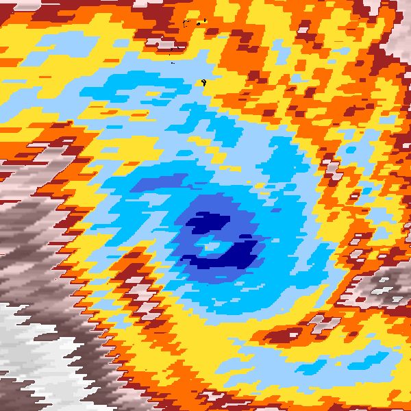
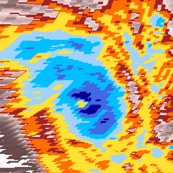
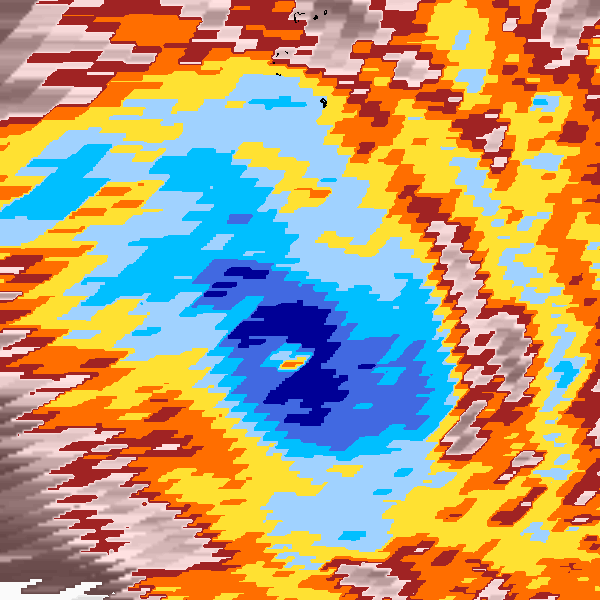
Intensity plots
|
Radial wind information
No radial wind information for this storm
|
Position and Intensity Table
Source Information
| Agency |
Information |
| USA |
bsh251979.txt |
| TOKYO |
|
| CMA |
|
| HKO |
|
| NEWDELHI |
|
| REUNION |
|
| BOM |
|
| NADI |
|
| WELLINGTON |
|
| DS824 |
s_hem.dat:1403:25S |
| TD9636 |
cons_worldwide_trop_cyclone_18710101-19891231-005:Line=11687 |
| TD9635 |
|
| NEUMANN |
|
| MLC |
|
All available IBTrACS Data
| SEASON |
BASIN |
SUBBASIN |
ISO_TIME_________ |
NATURE |
LAT |
LON |
DIST2LAND |
LANDFALL |
IFLAG |
USA AGENCY |
USA ATCF_ID |
USA LAT |
USA LON |
USA SSHS |
DS824 LAT |
DS824 LON |
DS824 STAGE |
DS824 WIND |
TD9636 LAT |
TD9636 LON |
TD9636 STAGE |
STORM SPEED |
STORM DIR |
| Year |
|
|
|
|
degrees north |
degrees east |
km |
km |
|
|
|
degrees north |
degrees east |
1 |
degrees north |
degrees east |
|
kts |
degrees north |
degrees east |
|
kts |
degrees |
| 1979 |
SI |
MM |
1979-04-06 06:00:00 |
TS |
-10.60 |
73.50 |
1998 |
1967 |
O________OO___ |
jtwc_sh |
SH251979 |
-10.60 |
73.50 |
-5 |
-10.60 |
73.50 |
TC |
35 |
-10.60 |
73.50 |
2 |
7 |
224 |
| 1979 |
SI |
MM |
09:00:00 |
TS |
-10.85 |
73.26 |
1967 |
1921 |
P________PP___ |
|
SH251979 |
-10.86 |
73.25 |
-5 |
-10.86 |
73.25 |
TC |
35 |
-10.83 |
73.25 |
2 |
7 |
225 |
| 1979 |
SI |
MM |
12:00:00 |
TS |
-11.09 |
73.01 |
1921 |
1891 |
O________OP___ |
jtwc_sh |
SH251979 |
-11.10 |
73.00 |
-5 |
-11.10 |
73.00 |
TC |
35 |
-11.05 |
73.00 |
2 |
7 |
227 |
| 1979 |
SI |
MM |
15:00:00 |
TS |
-11.30 |
72.77 |
1891 |
1851 |
P________PP___ |
|
SH251979 |
-11.31 |
72.76 |
-5 |
-11.31 |
72.76 |
TC |
35 |
-11.28 |
72.75 |
2 |
7 |
231 |
| 1979 |
SI |
MM |
18:00:00 |
TS |
-11.50 |
72.50 |
1851 |
1812 |
O________OO___ |
jtwc_sh |
SH251979 |
-11.50 |
72.50 |
-5 |
-11.50 |
72.50 |
TC |
35 |
-11.50 |
72.50 |
2 |
7 |
234 |
| 1979 |
SI |
MM |
21:00:00 |
TS |
-11.70 |
72.21 |
1812 |
1772 |
P________P____ |
|
SH251979 |
-11.70 |
72.21 |
-5 |
-11.70 |
72.21 |
TC |
35 |
|
|
2 |
7 |
236 |
| 1979 |
SI |
MM |
1979-04-07 00:00:00 |
TS |
-11.91 |
71.89 |
1772 |
1732 |
O________O____ |
jtwc_sh |
SH251979 |
-11.90 |
71.90 |
-5 |
-11.90 |
71.90 |
TC |
35 |
|
|
2 |
8 |
238 |
| 1979 |
SI |
MM |
03:00:00 |
TS |
-12.10 |
71.54 |
1723 |
|
______________ |
|
SH251979 |
|
|
-5 |
|
|
TC |
|
|
|
2 |
8 |
240 |