1960
Tropical Depression NOT_NAMED (1960278N16246)
IBTrACS version v04r00. Visit
IBTrACS website for data access.
Please direct all questions to the
IBTrACS Q and A forum
Storm track
-
Intensity
-
Wind Radii
-
Intensity Data
-
Source Data
-
All data
Summary Information
|
|
| Storm ID |
1960278N16246 |
| Start |
Oct 4 00Z |
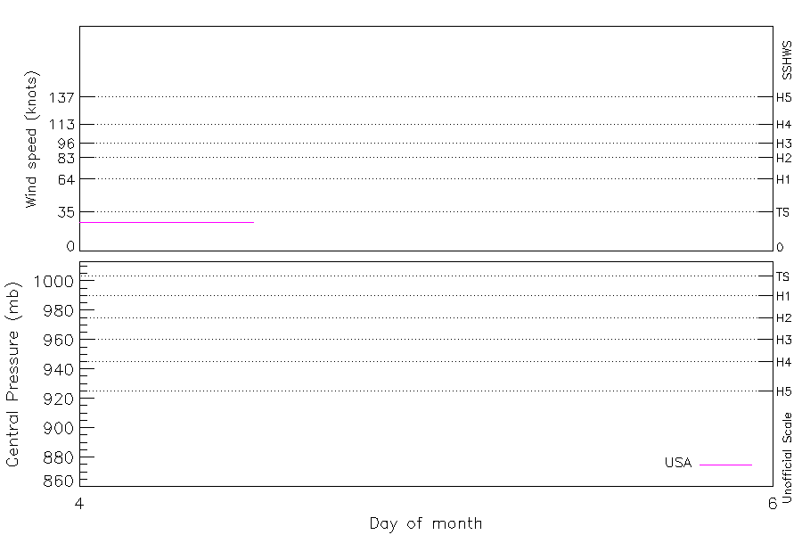
| Max Intensity |
26 kt (Oct 4 03Z) |
| End |
Oct 4 12Z |
| ATCF IDs |
EP071960 |
| Track status |
Best track data. |
|
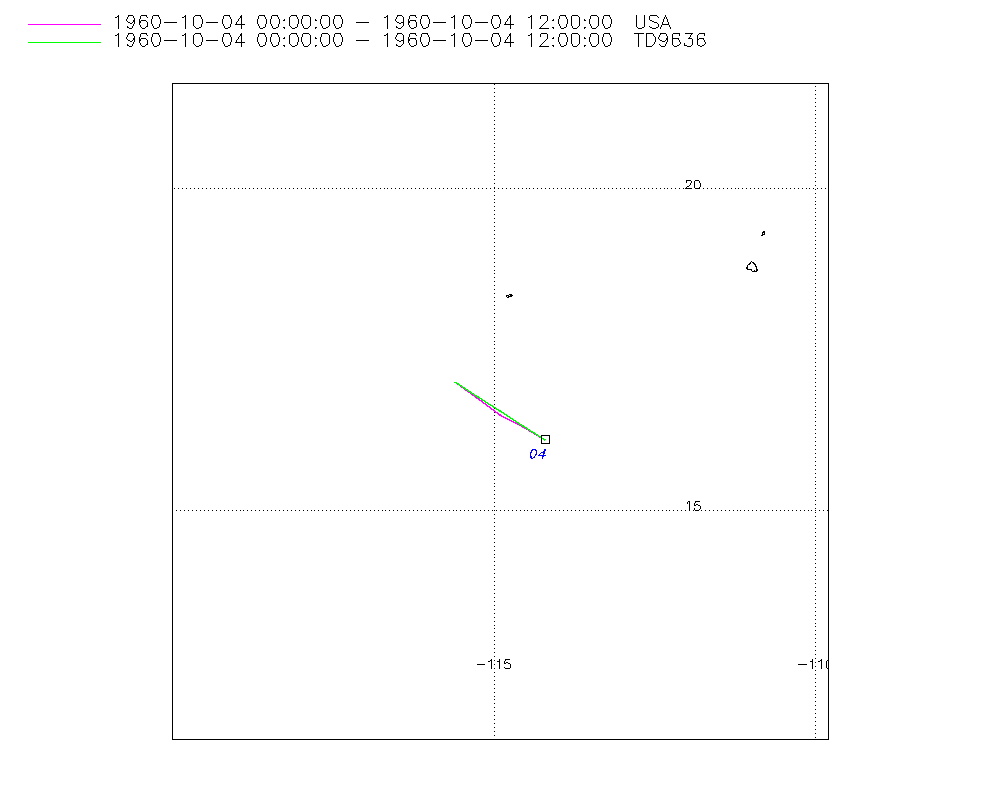
Storm track plot
|
Intensity plots
|
Radial wind information
No radial wind information for this storm
|
Position and Intensity Table
| BASIN |
ISO_TIME_________ |
NATURE |
LAT |
LON |
USA WIND |
| |
|
|
degrees north |
degrees east |
kts |
| EP |
1960-10-04 00:00:00 |
NR |
16.10 |
-114.20 |
26 |
| EP |
03:00:00 |
NR |
16.31 |
-114.55 |
26 |
| EP |
06:00:00 |
NR |
16.53 |
-114.90 |
26 |
| EP |
09:00:00 |
NR |
16.76 |
-115.25 |
26 |
| EP |
12:00:00 |
NR |
17.00 |
-115.60 |
26 |
Source Information
| Agency |
Information |
| USA |
bep071960.txt |
| TOKYO |
|
| CMA |
|
| HKO |
|
| NEWDELHI |
|
| REUNION |
|
| BOM |
|
| NADI |
|
| WELLINGTON |
|
| DS824 |
|
| TD9636 |
cons_worldwide_trop_cyclone_18710101-19891231-002:Line=991 |
| TD9635 |
|
| NEUMANN |
|
| MLC |
|
All available IBTrACS Data
| SEASON |
BASIN |
SUBBASIN |
ISO_TIME_________ |
NATURE |
LAT |
LON |
DIST2LAND |
LANDFALL |
IFLAG |
USA AGENCY |
USA ATCF_ID |
USA LAT |
USA LON |
USA WIND |
USA SSHS |
TD9636 LAT |
TD9636 LON |
TD9636 STAGE |
STORM SPEED |
STORM DIR |
| Year |
|
|
|
|
degrees north |
degrees east |
km |
km |
|
|
|
degrees north |
degrees east |
kts |
1 |
degrees north |
degrees east |
|
kts |
degrees |
| 1960 |
EP |
MM |
1960-10-04 00:00:00 |
NR |
16.10 |
-114.20 |
878 |
874 |
O_________O___ |
jtwc_ep |
EP071960 |
16.10 |
-114.20 |
26 |
-1 |
16.10 |
-114.20 |
4 |
8 |
302 |
| 1960 |
EP |
MM |
03:00:00 |
NR |
16.31 |
-114.55 |
875 |
871 |
P_________P___ |
|
EP071960 |
16.30 |
-114.55 |
26 |
-1 |
16.33 |
-114.55 |
4 |
8 |
302 |
| 1960 |
EP |
MM |
06:00:00 |
NR |
16.53 |
-114.90 |
880 |
871 |
O_________P___ |
jtwc_ep |
EP071960 |
16.50 |
-114.90 |
26 |
-1 |
16.55 |
-114.90 |
4 |
8 |
304 |
| 1960 |
EP |
MM |
09:00:00 |
NR |
16.76 |
-115.25 |
872 |
872 |
P_________P___ |
|
EP071960 |
16.75 |
-115.25 |
26 |
-1 |
16.78 |
-115.25 |
4 |
8 |
305 |
| 1960 |
EP |
MM |
12:00:00 |
NR |
17.00 |
-115.60 |
881 |
|
O_________O___ |
jtwc_ep |
EP071960 |
17.00 |
-115.60 |
26 |
-1 |
17.00 |
-115.60 |
4 |
8 |
305 |