1992
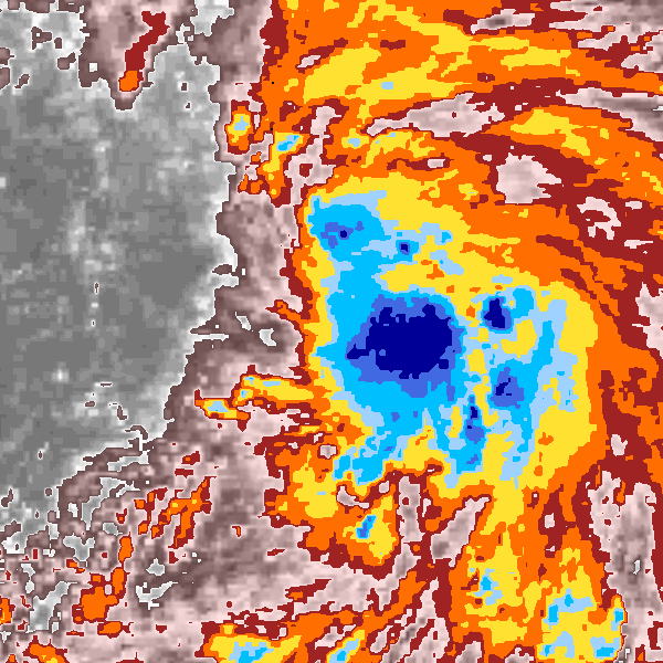
Tropical Storm VAL (1992265N06155)
IBTrACS version v04r00. Visit
IBTrACS website for data access.
Please direct all questions to the
IBTrACS Q and A forum
Storm track
-
Intensity
-
Wind Radii
-
Intensity Data
-
Source Data
-
All data
Summary Information
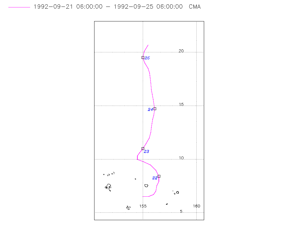
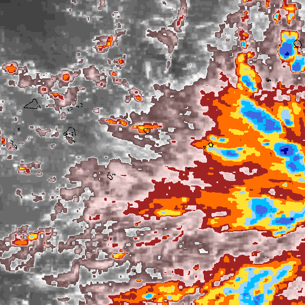
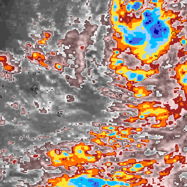
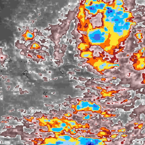
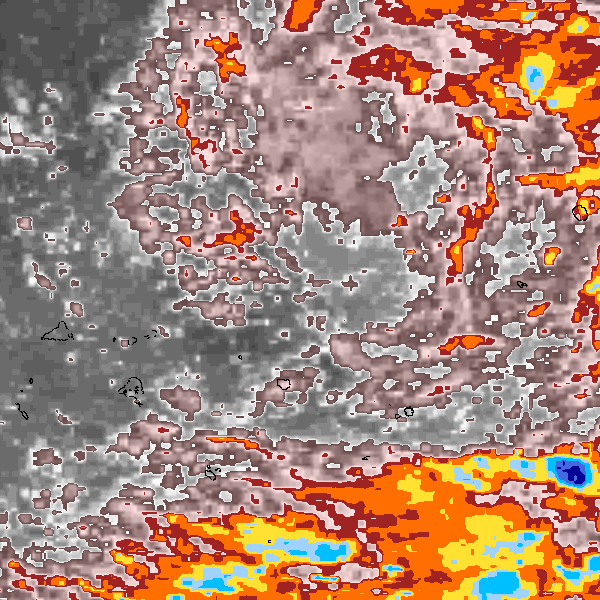
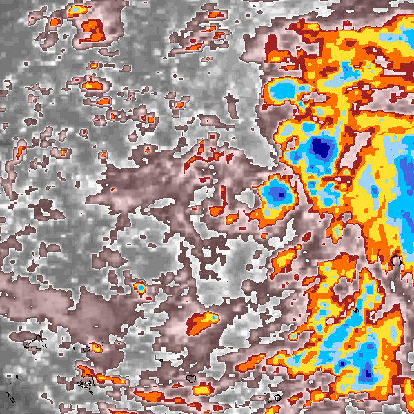
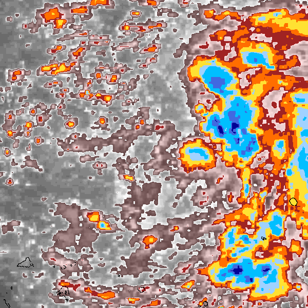
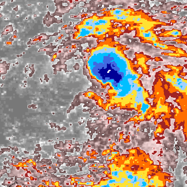
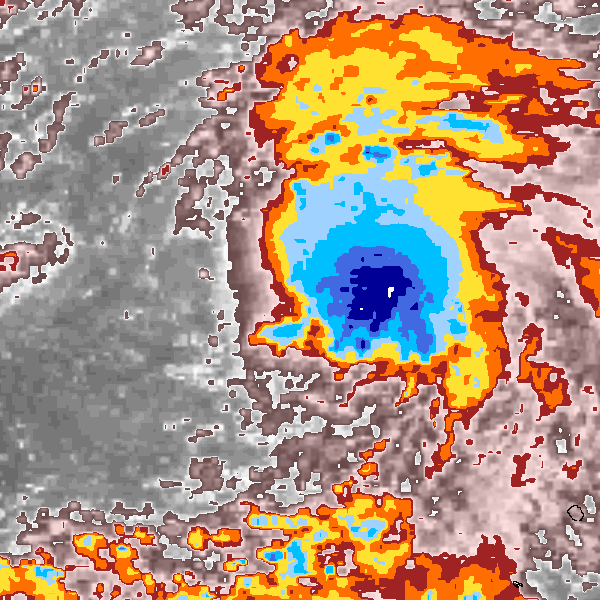
Storm track plot
|
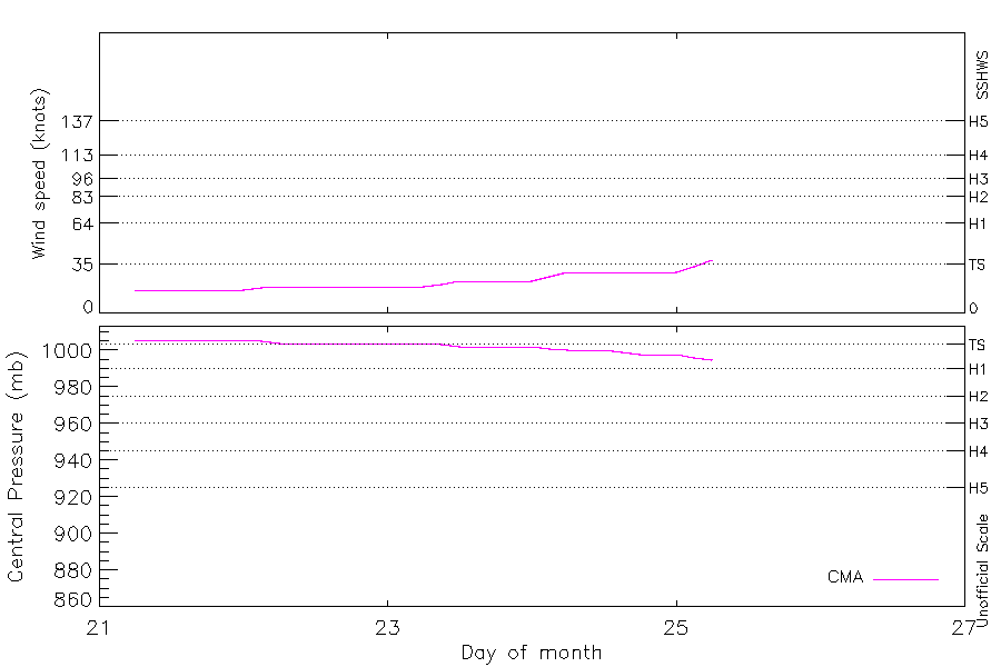
Intensity plots
|
Radial wind information
No radial wind information for this storm
|
Position and Intensity Table
Source Information
| Agency |
Information |
| USA |
|
| TOKYO |
|
| CMA |
CH1992BST.txt:Storm=22:Val |
| HKO |
|
| NEWDELHI |
|
| REUNION |
|
| BOM |
|
| NADI |
|
| WELLINGTON |
|
| DS824 |
|
| TD9636 |
|
| TD9635 |
|
| NEUMANN |
|
| MLC |
|
All available IBTrACS Data
| SEASON |
BASIN |
SUBBASIN |
ISO_TIME_________ |
NATURE |
LAT |
LON |
DIST2LAND |
LANDFALL |
IFLAG |
USA SSHS |
CMA LAT |
CMA LON |
CMA CAT |
CMA WIND |
CMA PRES |
STORM SPEED |
STORM DIR |
| Year |
|
|
|
|
degrees north |
degrees east |
km |
km |
|
1 |
degrees north |
degrees east |
1 |
kts |
mb |
kts |
degrees |
| 1992 |
WP |
MM |
1992-09-21 06:00:00 |
TS |
6.50 |
155.00 |
1127 |
1127 |
__O___________ |
-5 |
6.50 |
155.00 |
0 |
17 |
1006 |
11 |
86 |
| 1992 |
WP |
MM |
09:00:00 |
TS |
6.54 |
155.57 |
1155 |
1155 |
__P___________ |
-5 |
6.54 |
155.57 |
0 |
17 |
1006 |
10 |
79 |
| 1992 |
WP |
MM |
12:00:00 |
TS |
6.70 |
156.00 |
1196 |
1196 |
__O___________ |
-5 |
6.70 |
156.00 |
0 |
17 |
1006 |
8 |
52 |
| 1992 |
WP |
MM |
15:00:00 |
TS |
7.05 |
156.21 |
1236 |
1236 |
__P___________ |
-5 |
7.05 |
156.21 |
0 |
17 |
1006 |
9 |
20 |
| 1992 |
WP |
MM |
18:00:00 |
TS |
7.50 |
156.30 |
1290 |
1290 |
__O___________ |
-5 |
7.50 |
156.30 |
0 |
17 |
1006 |
9 |
17 |
| 1992 |
WP |
MM |
21:00:00 |
TS |
7.93 |
156.48 |
1340 |
1340 |
__P___________ |
-5 |
7.93 |
156.48 |
0 |
17 |
1006 |
9 |
12 |
| 1992 |
WP |
MM |
1992-09-22 00:00:00 |
TS |
8.40 |
156.50 |
1390 |
1390 |
__O___________ |
-5 |
8.40 |
156.50 |
0 |
17 |
1006 |
11 |
345 |
| 1992 |
WP |
MM |
03:00:00 |
TS |
8.98 |
156.21 |
1436 |
1436 |
__P___________ |
-5 |
8.98 |
156.21 |
0 |
18 |
1005 |
14 |
324 |
| 1992 |
WP |
MM |
06:00:00 |
TS |
9.50 |
155.70 |
1467 |
1463 |
__O___________ |
-5 |
9.50 |
155.70 |
0 |
19 |
1004 |
14 |
305 |
| 1992 |
WP |
MM |
09:00:00 |
TS |
9.79 |
155.03 |
1472 |
1465 |
__P___________ |
-5 |
9.79 |
155.03 |
0 |
19 |
1004 |
13 |
293 |
| 1992 |
WP |
MM |
12:00:00 |
TS |
10.00 |
154.50 |
1477 |
1477 |
__O___________ |
-5 |
10.00 |
154.50 |
0 |
19 |
1004 |
7 |
314 |
| 1992 |
WP |
MM |
15:00:00 |
TS |
10.31 |
154.49 |
1510 |
1510 |
__P___________ |
-5 |
10.31 |
154.49 |
0 |
19 |
1004 |
6 |
18 |
| 1992 |
WP |
MM |
18:00:00 |
TS |
10.60 |
154.70 |
1548 |
1548 |
__O___________ |
-5 |
10.60 |
154.70 |
0 |
19 |
1004 |
6 |
35 |
| 1992 |
WP |
MM |
21:00:00 |
TS |
10.77 |
154.82 |
1573 |
1573 |
__P___________ |
-5 |
10.77 |
154.82 |
0 |
19 |
1004 |
5 |
36 |
| 1992 |
WP |
MM |
1992-09-23 00:00:00 |
TS |
11.00 |
155.00 |
1600 |
1600 |
__O___________ |
-5 |
11.00 |
155.00 |
0 |
19 |
1004 |
8 |
35 |
| 1992 |
WP |
MM |
03:00:00 |
TS |
11.46 |
155.31 |
1663 |
1663 |
__P___________ |
-5 |
11.46 |
155.31 |
0 |
19 |
1004 |
12 |
30 |
| 1992 |
WP |
MM |
06:00:00 |
TS |
12.00 |
155.60 |
1727 |
1727 |
__O___________ |
-5 |
12.00 |
155.60 |
0 |
19 |
1004 |
12 |
22 |
| 1992 |
WP |
MM |
09:00:00 |
TS |
12.52 |
155.74 |
1783 |
1783 |
__P___________ |
-5 |
12.52 |
155.74 |
0 |
21 |
1003 |
10 |
11 |
| 1992 |
WP |
MM |
12:00:00 |
TS |
13.00 |
155.80 |
1840 |
1840 |
__O___________ |
-5 |
13.00 |
155.80 |
1 |
23 |
1002 |
8 |
7 |
| 1992 |
WP |
MM |
15:00:00 |
TS |
13.35 |
155.85 |
1875 |
1875 |
__P___________ |
-5 |
13.35 |
155.85 |
1 |
23 |
1002 |
7 |
8 |
| 1992 |
WP |
MM |
18:00:00 |
TS |
13.70 |
155.90 |
1918 |
1918 |
__O___________ |
-5 |
13.70 |
155.90 |
1 |
23 |
1002 |
8 |
13 |
| 1992 |
WP |
MM |
21:00:00 |
TS |
14.12 |
156.03 |
1964 |
1964 |
__P___________ |
-5 |
14.12 |
156.03 |
1 |
23 |
1002 |
10 |
11 |
| 1992 |
WP |
MM |
1992-09-24 00:00:00 |
TS |
14.70 |
156.10 |
2031 |
2031 |
__O___________ |
-5 |
14.70 |
156.10 |
1 |
23 |
1002 |
15 |
358 |
| 1992 |
WP |
MM |
03:00:00 |
TS |
15.59 |
155.97 |
2125 |
2125 |
__P___________ |
-5 |
15.59 |
155.97 |
1 |
26 |
1001 |
18 |
351 |
| 1992 |
WP |
MM |
06:00:00 |
TS |
16.50 |
155.80 |
2217 |
2217 |
__O___________ |
-5 |
16.50 |
155.80 |
1 |
29 |
1000 |
16 |
352 |
| 1992 |
WP |
MM |
09:00:00 |
TS |
17.12 |
155.74 |
2279 |
2279 |
__P___________ |
-5 |
17.12 |
155.74 |
1 |
29 |
1000 |
11 |
355 |
| 1992 |
WP |
MM |
12:00:00 |
TS |
17.60 |
155.70 |
2334 |
2334 |
__O___________ |
-5 |
17.60 |
155.70 |
1 |
29 |
1000 |
10 |
354 |
| 1992 |
WP |
MM |
15:00:00 |
TS |
18.06 |
155.63 |
2386 |
2384 |
__P___________ |
-5 |
18.06 |
155.63 |
1 |
29 |
999 |
9 |
348 |
| 1992 |
WP |
MM |
18:00:00 |
TS |
18.50 |
155.50 |
2384 |
2329 |
__O___________ |
-5 |
18.50 |
155.50 |
1 |
29 |
998 |
10 |
336 |
| 1992 |
WP |
MM |
21:00:00 |
TS |
18.98 |
155.20 |
2320 |
2263 |
__P___________ |
-5 |
18.98 |
155.20 |
1 |
29 |
998 |
11 |
335 |
| 1992 |
WP |
MM |
1992-09-25 00:00:00 |
TS |
19.50 |
155.00 |
2263 |
2230 |
__O___________ |
-5 |
19.50 |
155.00 |
1 |
29 |
998 |
11 |
0 |
| 1992 |
WP |
MM |
03:00:00 |
TS |
20.05 |
155.23 |
2230 |
2188 |
__P___________ |
-5 |
20.08 |
155.14 |
1 |
33 |
996 |
13 |
21 |
| 1992 |
WP |
MM |
06:00:00 |
TS |
20.70 |
155.50 |
2188 |
|
__O___________ |
-5 |
20.70 |
155.50 |
2 |
38 |
995 |
14 |
22 |