1991
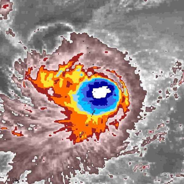
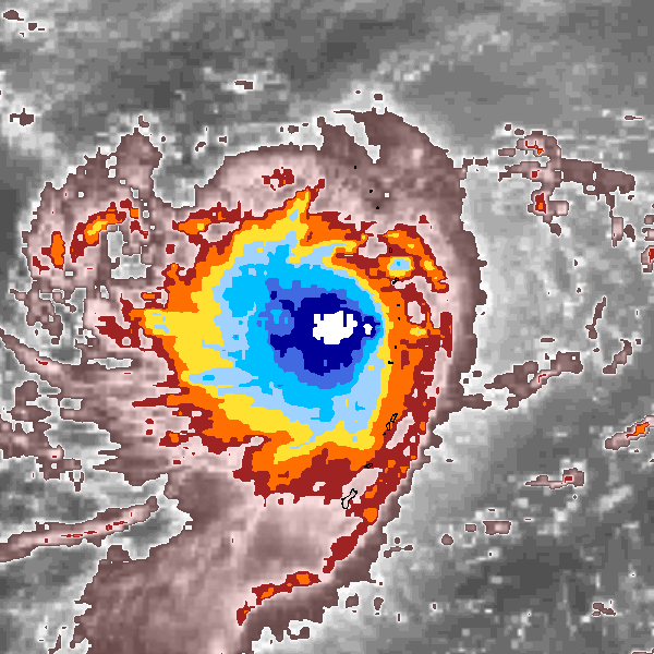
Tropical Storm VERNE (1991313N17146)
IBTrACS version v04r00. Visit
IBTrACS website for data access.
Please direct all questions to the
IBTrACS Q and A forum
Storm track
-
Intensity
-
Wind Radii
-
Intensity Data
-
Source Data
-
All data
Summary Information
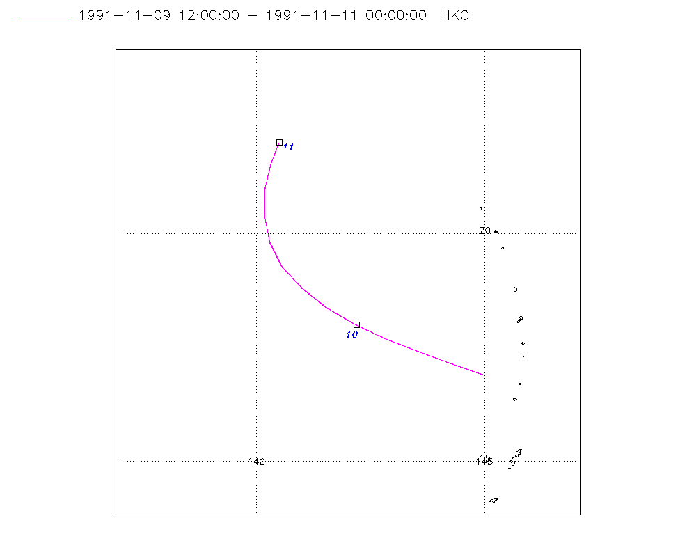
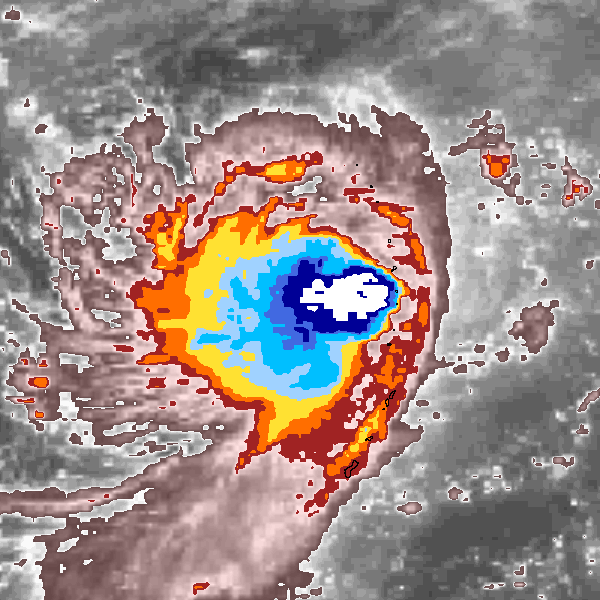
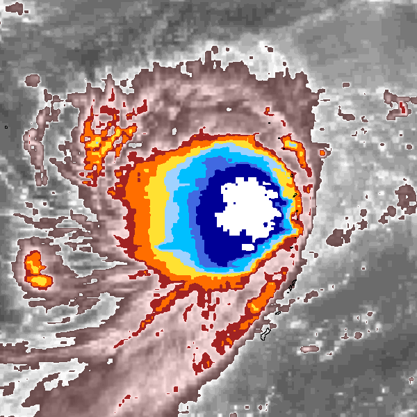
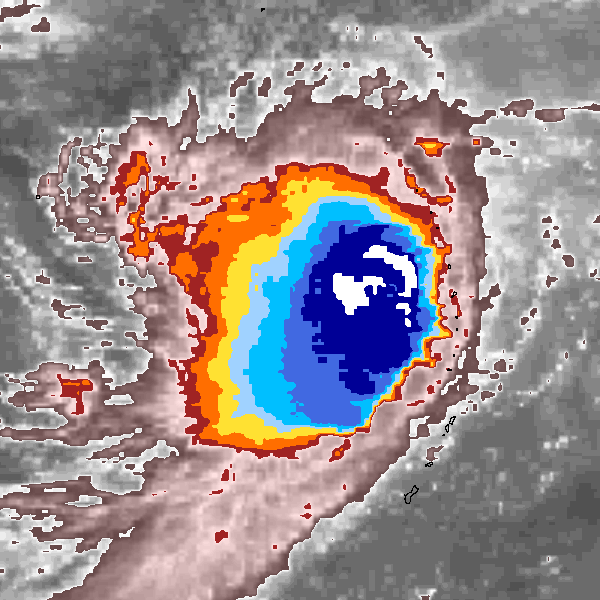
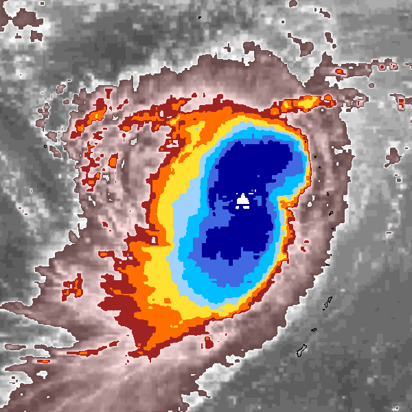
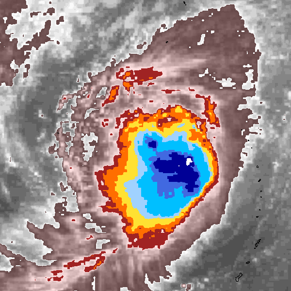
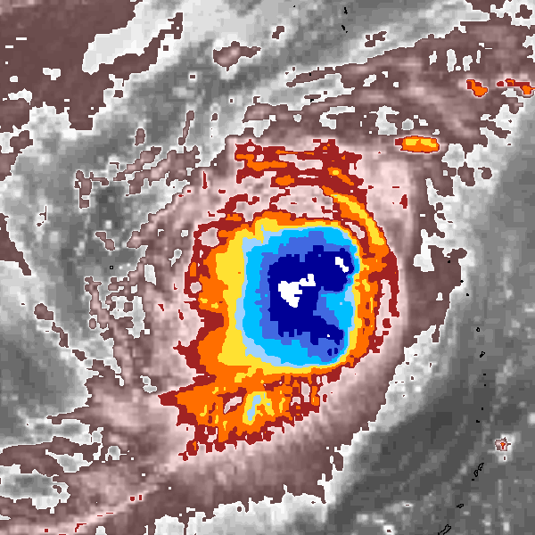
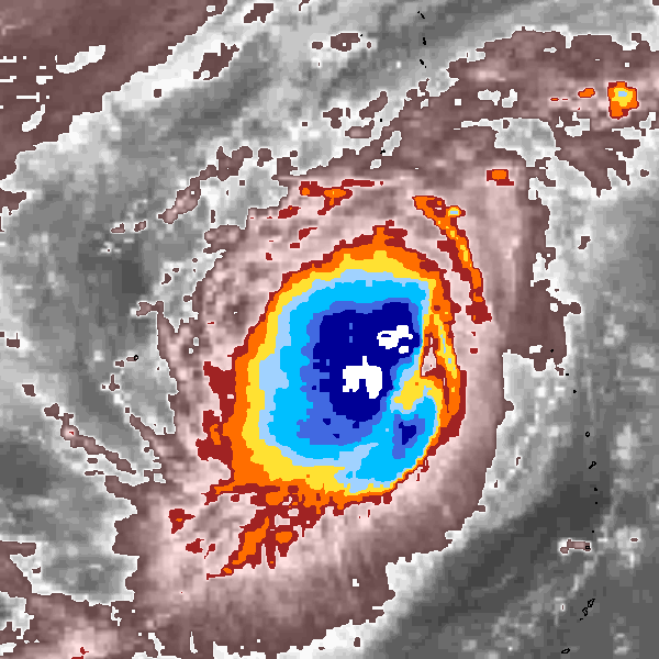
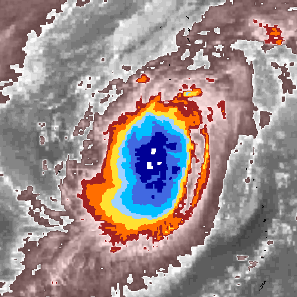
Storm track plot
|
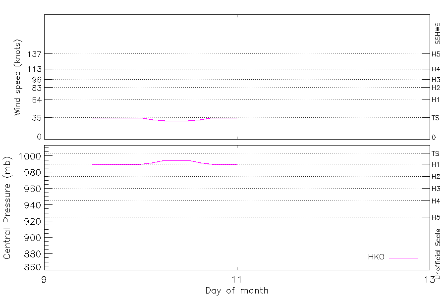
Intensity plots
|
Radial wind information
No radial wind information for this storm
|
Position and Intensity Table
Source Information
| Agency |
Information |
| USA |
|
| TOKYO |
|
| CMA |
|
| HKO |
tc-besttrack-data-current.txt:Line=22029:VERNE |
| NEWDELHI |
|
| REUNION |
|
| BOM |
|
| NADI |
|
| WELLINGTON |
|
| DS824 |
|
| TD9636 |
|
| TD9635 |
|
| NEUMANN |
|
| MLC |
|
All available IBTrACS Data
| SEASON |
BASIN |
SUBBASIN |
ISO_TIME_________ |
NATURE |
LAT |
LON |
DIST2LAND |
LANDFALL |
IFLAG |
USA SSHS |
HKO LAT |
HKO LON |
HKO CAT |
HKO WIND |
HKO PRES |
STORM SPEED |
STORM DIR |
| Year |
|
|
|
|
degrees north |
degrees east |
km |
km |
|
1 |
degrees north |
degrees east |
|
kts |
mb |
kts |
degrees |
| 1991 |
WP |
MM |
1991-11-09 09:00:00 |
NR |
16.68 |
145.59 |
2107 |
2060 |
______________ |
-5 |
|
|
|
|
|
12 |
291 |
| 1991 |
WP |
MM |
12:00:00 |
NR |
16.90 |
145.00 |
2060 |
2013 |
___O__________ |
-5 |
16.90 |
145.00 |
TS |
35 |
990 |
13 |
290 |
| 1991 |
WP |
MM |
15:00:00 |
NR |
17.13 |
144.32 |
2009 |
1949 |
___P__________ |
-5 |
17.15 |
144.31 |
TS |
35 |
990 |
14 |
290 |
| 1991 |
WP |
MM |
18:00:00 |
NR |
17.40 |
143.60 |
1949 |
1891 |
___O__________ |
-5 |
17.40 |
143.60 |
TS |
35 |
990 |
15 |
292 |
| 1991 |
WP |
MM |
21:00:00 |
NR |
17.68 |
142.88 |
1891 |
1834 |
___P__________ |
-5 |
17.68 |
142.88 |
TS |
35 |
990 |
15 |
294 |
| 1991 |
WP |
MM |
1991-11-10 00:00:00 |
NR |
18.00 |
142.20 |
1834 |
1782 |
___O__________ |
-5 |
18.00 |
142.20 |
TS |
35 |
990 |
15 |
299 |
| 1991 |
WP |
MM |
03:00:00 |
NR |
18.37 |
141.55 |
1768 |
1705 |
___P__________ |
-5 |
18.37 |
141.55 |
TS |
32 |
992 |
14 |
305 |
| 1991 |
WP |
MM |
06:00:00 |
NR |
18.80 |
141.00 |
1705 |
1644 |
___O__________ |
-5 |
18.80 |
141.00 |
TD |
30 |
995 |
13 |
314 |
| 1991 |
WP |
MM |
09:00:00 |
NR |
19.27 |
140.57 |
1635 |
1571 |
___P__________ |
-5 |
19.27 |
140.57 |
TD |
30 |
995 |
12 |
327 |
| 1991 |
WP |
MM |
12:00:00 |
NR |
19.80 |
140.30 |
1571 |
1509 |
___O__________ |
-5 |
19.80 |
140.30 |
TD |
30 |
995 |
12 |
342 |
| 1991 |
WP |
MM |
15:00:00 |
NR |
20.40 |
140.17 |
1509 |
1450 |
___P__________ |
-5 |
20.40 |
140.17 |
TD |
32 |
992 |
12 |
355 |
| 1991 |
WP |
MM |
18:00:00 |
NR |
21.00 |
140.20 |
1450 |
1400 |
___O__________ |
-5 |
21.00 |
140.20 |
TS |
35 |
990 |
11 |
6 |
| 1991 |
WP |
MM |
21:00:00 |
NR |
21.51 |
140.30 |
1400 |
1353 |
___P__________ |
-5 |
21.53 |
140.32 |
TS |
35 |
990 |
10 |
16 |
| 1991 |
WP |
MM |
1991-11-11 00:00:00 |
NR |
22.00 |
140.50 |
1353 |
|
___O__________ |
-5 |
22.00 |
140.50 |
TS |
35 |
990 |
10 |
20 |