1987
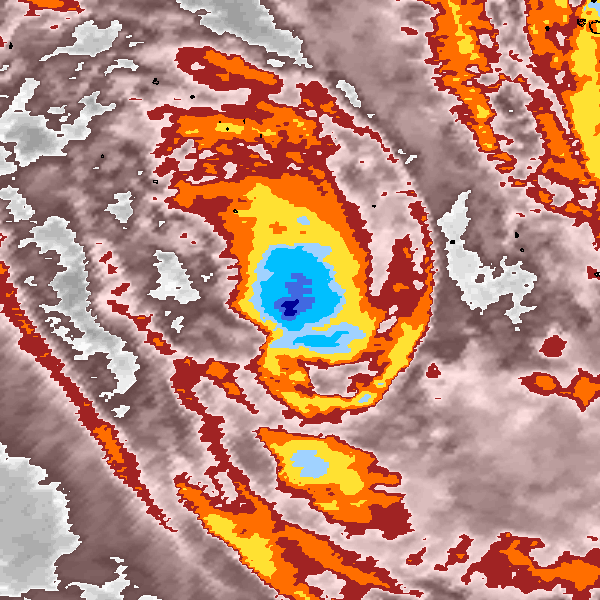
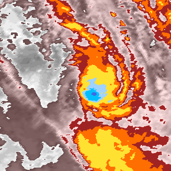
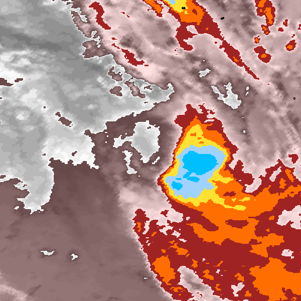
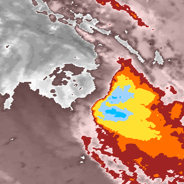
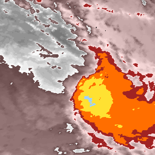
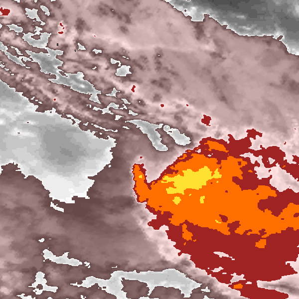
Tropical Cyclone (Gale) NOT_NAMED (1987059S12196)
IBTrACS version v04r00. Visit
IBTrACS website for data access.
Please direct all questions to the
IBTrACS Q and A forum
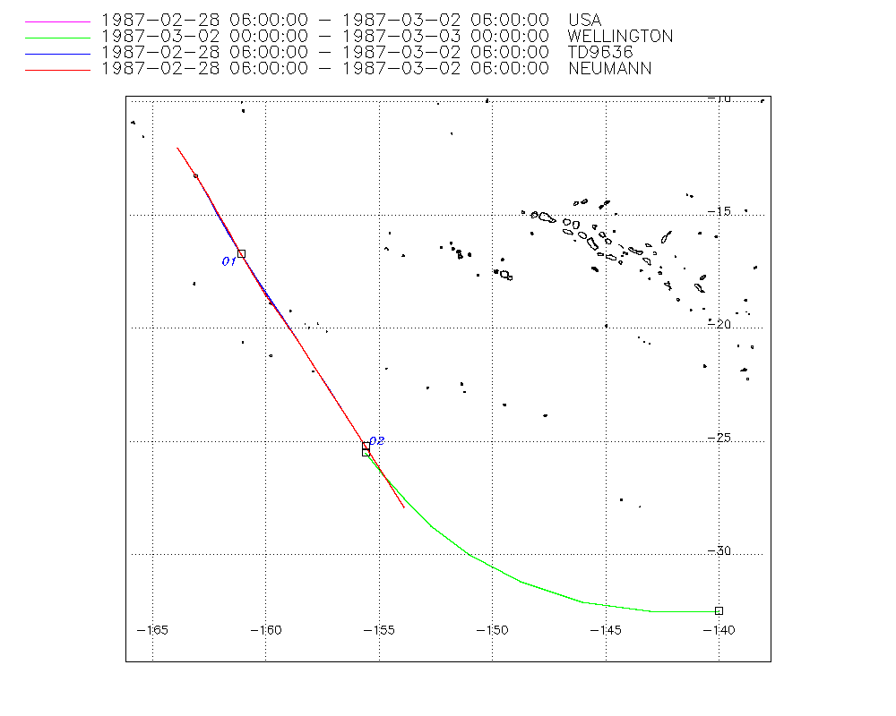
Storm track
-
Intensity
-
Wind Radii
-
Intensity Data
-
Source Data
-
All data
Summary Information
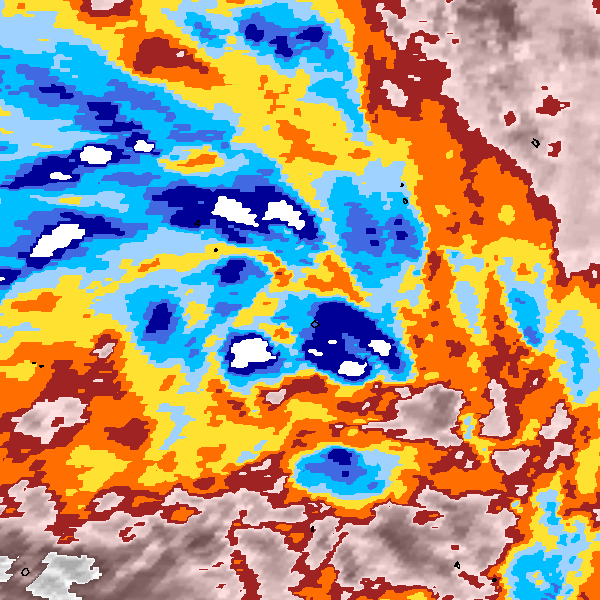
Storm track plot
|
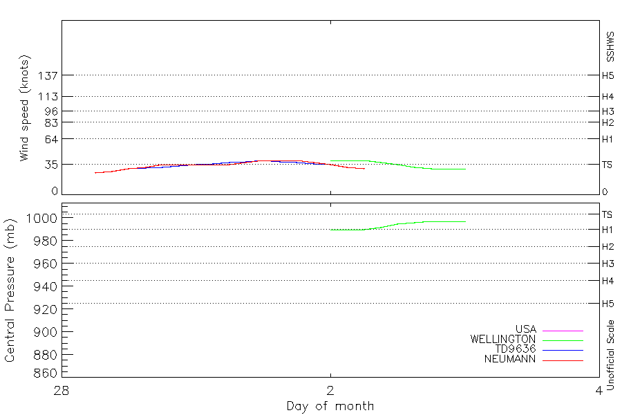
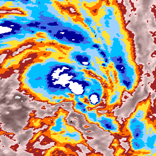
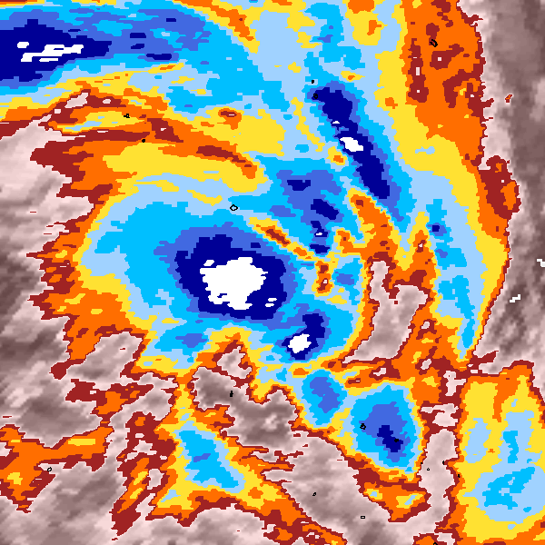
Intensity plots
|
Radial wind information
No radial wind information for this storm
|
Position and Intensity Table
| BASIN |
ISO_TIME_________ |
NATURE |
LAT |
LON |
WMO WIND |
WMO PRES |
USA WIND |
WELLINGTON WIND |
WELLINGTON PRES |
TD9636 WIND |
NEUMANN WIND |
| |
|
|
degrees north |
degrees east |
kts |
mb |
kts |
kts |
mb |
kts |
kts |
| SP |
1987-02-28 06:00:00 |
TS |
-12.00 |
-163.90 |
|
|
25 |
|
|
25 |
25 |
| SP |
09:00:00 |
TS |
-12.69 |
-163.45 |
|
|
27 |
|
|
27 |
27 |
| SP |
12:00:00 |
TS |
-13.40 |
-163.00 |
35 |
995 |
30 |
|
|
30 |
30 |
| SP |
15:00:00 |
TS |
-14.13 |
-162.56 |
|
|
32 |
|
|
31 |
32 |
| SP |
18:00:00 |
TS |
-14.92 |
-162.10 |
40 |
990 |
35 |
|
|
32 |
35 |
| SP |
21:00:00 |
TS |
-15.79 |
-161.62 |
|
|
35 |
|
|
33 |
35 |
| SP |
1987-03-01 00:00:00 |
TS |
-16.70 |
-161.10 |
45 |
987 |
35 |
|
|
35 |
35 |
| SP |
03:00:00 |
TS |
-17.58 |
-160.56 |
|
|
35 |
|
|
36 |
35 |
| SP |
06:00:00 |
TS |
-18.50 |
-159.98 |
50 |
985 |
35 |
|
|
37 |
35 |
| SP |
09:00:00 |
TS |
-19.47 |
-159.31 |
|
|
37 |
|
|
38 |
37 |
| SP |
12:00:00 |
TS |
-20.50 |
-158.60 |
50 |
985 |
40 |
|
|
40 |
40 |
| SP |
15:00:00 |
TS |
-21.57 |
-157.91 |
|
|
40 |
|
|
38 |
40 |
| SP |
18:00:00 |
TS |
-22.71 |
-157.19 |
45 |
987 |
40 |
|
|
37 |
40 |
| SP |
21:00:00 |
TS |
-23.97 |
-156.41 |
|
|
37 |
|
|
36 |
37 |
| SP |
1987-03-02 00:00:00 |
TS |
-25.25 |
-155.60 |
40 |
990 |
35 |
40 |
990 |
35 |
35 |
| SP |
03:00:00 |
TS |
-26.50 |
-154.79 |
|
|
32 |
40 |
990 |
32 |
32 |
| SP |
06:00:00 |
TS |
-27.67 |
-153.90 |
40 |
990 |
30 |
40 |
990 |
30 |
30 |
| SP |
09:00:00 |
NR |
-28.74 |
-152.69 |
|
|
|
37 |
992 |
|
|
| SP |
12:00:00 |
NR |
-30.00 |
-151.00 |
35 |
995 |
|
35 |
995 |
|
|
| SP |
15:00:00 |
NR |
-31.21 |
-148.74 |
|
|
|
32 |
996 |
|
|
| SP |
18:00:00 |
NR |
-32.10 |
-146.00 |
30 |
997 |
|
30 |
997 |
|
|
| SP |
21:00:00 |
NR |
-32.47 |
-143.04 |
|
|
|
30 |
997 |
|
|
| SP |
1987-03-03 00:00:00 |
NR |
-32.50 |
-140.00 |
30 |
997 |
|
30 |
997 |
|
|
Source Information
| Agency |
Information |
| USA |
bsh191987.txt |
| TOKYO |
|
| CMA |
|
| HKO |
|
| NEWDELHI |
|
| REUNION |
|
| BOM |
|
| NADI |
|
| WELLINGTON |
TC_BT_1967_2006.csv:Line=2798:NONAME |
| DS824 |
|
| TD9636 |
cons_worldwide_trop_cyclone_18710101-19891231-006:Line=12961 |
| TD9635 |
|
| NEUMANN |
tracks.sh:Storm=805:HSK2087:BSH191987:JTWC&NZeal884 |
| MLC |
|
All available IBTrACS Data
| SEASON |
BASIN |
SUBBASIN |
ISO_TIME_________ |
NATURE |
LAT |
LON |
WMO WIND |
WMO PRES |
WMO AGENCY |
DIST2LAND |
LANDFALL |
IFLAG |
USA AGENCY |
USA ATCF_ID |
USA LAT |
USA LON |
USA WIND |
USA SSHS |
WELLINGTON LAT |
WELLINGTON LON |
WELLINGTON WIND |
WELLINGTON PRES |
TD9636 LAT |
TD9636 LON |
TD9636 STAGE |
TD9636 WIND |
NEUMANN LAT |
NEUMANN LON |
NEUMANN CLASS |
NEUMANN WIND |
STORM SPEED |
STORM DIR |
| Year |
|
|
|
|
degrees north |
degrees east |
kts |
mb |
|
km |
km |
|
|
|
degrees north |
degrees east |
kts |
1 |
degrees north |
degrees east |
kts |
mb |
degrees north |
degrees east |
|
kts |
degrees north |
degrees east |
|
kts |
kts |
degrees |
| 1987 |
SP |
MM |
1987-02-28 06:00:00 |
TS |
-12.00 |
-163.90 |
|
|
|
920 |
920 |
O_________O_O_ |
jtwc_sh |
SH191987 |
-12.00 |
-163.90 |
25 |
-1 |
|
|
|
|
-12.00 |
-163.90 |
1 |
25 |
-12.00 |
-163.90 |
TC |
25 |
17 |
147 |
| 1987 |
SP |
MM |
09:00:00 |
TS |
-12.69 |
-163.45 |
|
|
|
959 |
958 |
P_________P_P_ |
|
SH191987 |
-12.70 |
-163.45 |
27 |
-1 |
|
|
|
|
-12.69 |
-163.45 |
1 |
27 |
-12.70 |
-163.45 |
TC |
27 |
17 |
148 |
| 1987 |
SP |
MM |
12:00:00 |
TS |
-13.40 |
-163.00 |
35 |
995 |
wellington |
995 |
995 |
O_________O_O_ |
jtwc_sh |
SH191987 |
-13.40 |
-163.00 |
30 |
-1 |
|
|
|
|
-13.40 |
-163.00 |
1 |
30 |
-13.40 |
-163.00 |
TC |
30 |
17 |
149 |
| 1987 |
SP |
MM |
15:00:00 |
TS |
-14.13 |
-162.56 |
|
|
|
1037 |
1037 |
P_________P_P_ |
|
SH191987 |
-14.12 |
-162.56 |
32 |
-1 |
|
|
|
|
-14.16 |
-162.55 |
1 |
31 |
-14.12 |
-162.56 |
TC |
32 |
18 |
150 |
| 1987 |
SP |
MM |
18:00:00 |
TS |
-14.92 |
-162.10 |
40 |
990 |
wellington |
1095 |
1095 |
O_________P_O_ |
jtwc_sh |
SH191987 |
-14.90 |
-162.10 |
35 |
0 |
|
|
|
|
-14.96 |
-162.10 |
1 |
32 |
-14.90 |
-162.10 |
TC |
35 |
19 |
151 |
| 1987 |
SP |
MM |
21:00:00 |
TS |
-15.79 |
-161.62 |
|
|
|
1161 |
1161 |
P_________P_P_ |
|
SH191987 |
-15.78 |
-161.61 |
35 |
0 |
|
|
|
|
-15.81 |
-161.62 |
1 |
33 |
-15.78 |
-161.61 |
TC |
35 |
20 |
152 |
| 1987 |
SP |
MM |
1987-03-01 00:00:00 |
TS |
-16.70 |
-161.10 |
45 |
987 |
wellington |
1234 |
1234 |
O_________O_O_ |
jtwc_sh |
SH191987 |
-16.70 |
-161.10 |
35 |
0 |
|
|
|
|
-16.70 |
-161.10 |
2 |
35 |
-16.70 |
-161.10 |
TC |
35 |
21 |
151 |
| 1987 |
SP |
MM |
03:00:00 |
TS |
-17.58 |
-160.56 |
|
|
|
1312 |
1312 |
P_________P_P_ |
|
SH191987 |
-17.58 |
-160.58 |
35 |
0 |
|
|
|
|
-17.58 |
-160.54 |
2 |
36 |
-17.58 |
-160.58 |
TC |
35 |
21 |
149 |
| 1987 |
SP |
MM |
06:00:00 |
TS |
-18.50 |
-159.98 |
50 |
985 |
wellington |
1405 |
1405 |
O_________P_O_ |
jtwc_sh |
SH191987 |
-18.50 |
-160.00 |
35 |
0 |
|
|
|
|
-18.49 |
-159.93 |
2 |
37 |
-18.50 |
-160.00 |
TC |
35 |
22 |
148 |
| 1987 |
SP |
MM |
09:00:00 |
TS |
-19.47 |
-159.31 |
|
|
|
1514 |
1514 |
P_________P_P_ |
|
SH191987 |
-19.47 |
-159.32 |
37 |
0 |
|
|
|
|
-19.46 |
-159.28 |
2 |
38 |
-19.47 |
-159.32 |
TC |
37 |
24 |
147 |
| 1987 |
SP |
MM |
12:00:00 |
TS |
-20.50 |
-158.60 |
50 |
985 |
wellington |
1627 |
1627 |
O_________O_O_ |
jtwc_sh |
SH191987 |
-20.50 |
-158.60 |
40 |
0 |
|
|
|
|
-20.50 |
-158.60 |
2 |
40 |
-20.50 |
-158.60 |
TC |
40 |
25 |
148 |
| 1987 |
SP |
MM |
15:00:00 |
TS |
-21.57 |
-157.91 |
|
|
|
1746 |
1746 |
P_________P_P_ |
|
SH191987 |
-21.56 |
-157.91 |
40 |
0 |
|
|
|
|
-21.57 |
-157.90 |
2 |
38 |
-21.56 |
-157.91 |
TC |
40 |
26 |
149 |
| 1987 |
SP |
MM |
18:00:00 |
TS |
-22.71 |
-157.19 |
45 |
987 |
wellington |
1868 |
1868 |
O_________P_O_ |
jtwc_sh |
SH191987 |
-22.70 |
-157.20 |
40 |
0 |
|
|
|
|
-22.72 |
-157.17 |
2 |
37 |
-22.70 |
-157.20 |
TC |
40 |
28 |
150 |
| 1987 |
SP |
MM |
21:00:00 |
TS |
-23.97 |
-156.41 |
|
|
|
2013 |
2013 |
P_________P_P_ |
|
SH191987 |
-23.91 |
-156.42 |
37 |
0 |
|
|
|
|
-23.93 |
-156.40 |
2 |
36 |
-23.91 |
-156.42 |
TC |
37 |
29 |
150 |
| 1987 |
SP |
MM |
1987-03-02 00:00:00 |
TS |
-25.25 |
-155.60 |
40 |
990 |
wellington |
2159 |
2159 |
O_______O_O_O_ |
jtwc_sh |
SH191987 |
-25.20 |
-155.60 |
35 |
0 |
-25.50 |
-155.60 |
40 |
990 |
-25.20 |
-155.60 |
2 |
35 |
-25.20 |
-155.60 |
TC |
35 |
29 |
150 |
| 1987 |
SP |
MM |
03:00:00 |
TS |
-26.50 |
-154.79 |
|
|
|
2300 |
2300 |
P_______P_P_P_ |
|
SH191987 |
-26.54 |
-154.76 |
32 |
-1 |
-26.44 |
-154.82 |
40 |
990 |
-26.53 |
-154.76 |
2 |
32 |
-26.54 |
-154.76 |
TC |
32 |
29 |
148 |
| 1987 |
SP |
MM |
06:00:00 |
TS |
-27.67 |
-153.90 |
40 |
990 |
wellington |
2450 |
2450 |
O_______O_O_O_ |
jtwc_sh |
SH191987 |
-27.90 |
-153.90 |
30 |
-1 |
-27.50 |
-153.90 |
40 |
990 |
-27.90 |
-153.90 |
1 |
30 |
-27.90 |
-153.90 |
TC |
30 |
29 |
140 |
| 1987 |
SP |
MM |
09:00:00 |
NR |
-28.74 |
-152.69 |
|
|
|
2611 |
2611 |
________P_____ |
|
SH191987 |
|
|
|
-5 |
-28.74 |
-152.69 |
37 |
992 |
|
|
1 |
|
|
|
TC |
|
35 |
132 |
| 1987 |
SP |
MM |
12:00:00 |
NR |
-30.00 |
-151.00 |
35 |
995 |
wellington |
2829 |
2829 |
________O_____ |
|
|
|
|
|
-5 |
-30.00 |
-151.00 |
35 |
995 |
|
|
|
|
|
|
|
|
42 |
126 |
| 1987 |
SP |
MM |
15:00:00 |
NR |
-31.21 |
-148.74 |
|
|
|
3061 |
3061 |
________P_____ |
|
|
|
|
|
-5 |
-31.21 |
-148.74 |
32 |
996 |
|
|
|
|
|
|
|
|
48 |
116 |
| 1987 |
SP |
MM |
18:00:00 |
NR |
-32.10 |
-146.00 |
30 |
997 |
wellington |
3260 |
3260 |
________O_____ |
|
|
|
|
|
-5 |
-32.10 |
-146.00 |
30 |
997 |
|
|
|
|
|
|
|
|
50 |
105 |
| 1987 |
SP |
MM |
21:00:00 |
NR |
-32.47 |
-143.04 |
|
|
|
3508 |
3508 |
________P_____ |
|
|
|
|
|
-5 |
-32.47 |
-143.04 |
30 |
997 |
|
|
|
|
|
|
|
|
51 |
95 |
| 1987 |
SP |
MM |
1987-03-03 00:00:00 |
NR |
-32.50 |
-140.00 |
30 |
997 |
wellington |
3771 |
|
________O_____ |
|
|
|
|
|
-5 |
-32.50 |
-140.00 |
30 |
997 |
|
|
|
|
|
|
|
|
51 |
91 |