1984
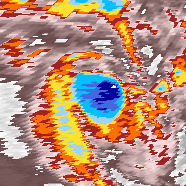
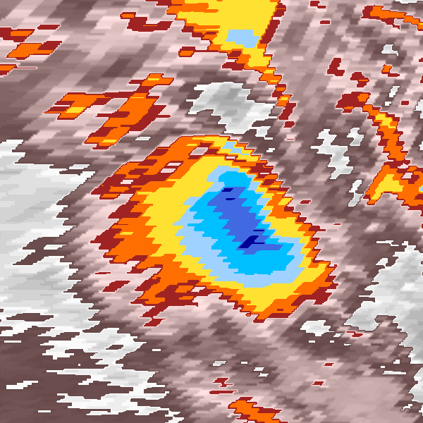
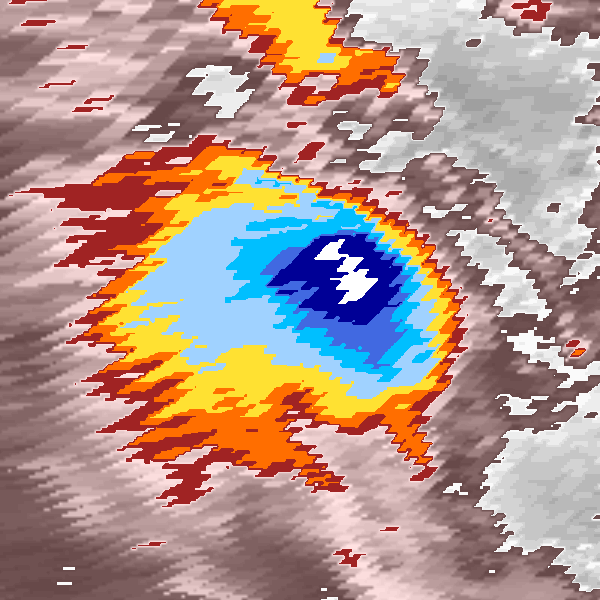
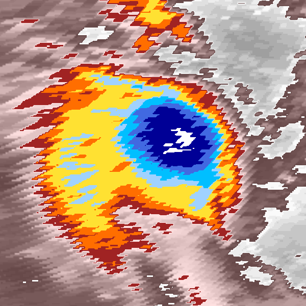
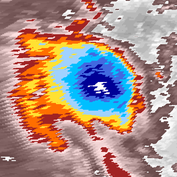
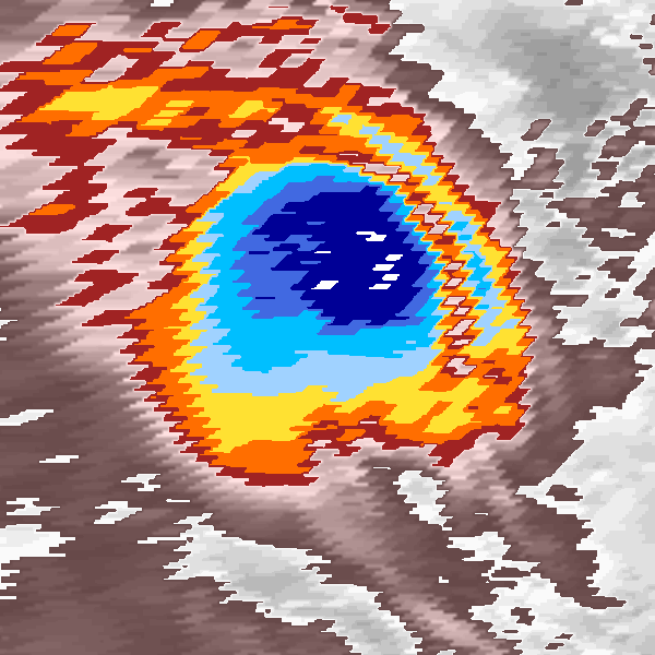
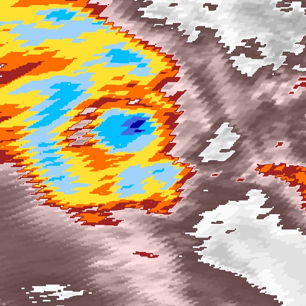
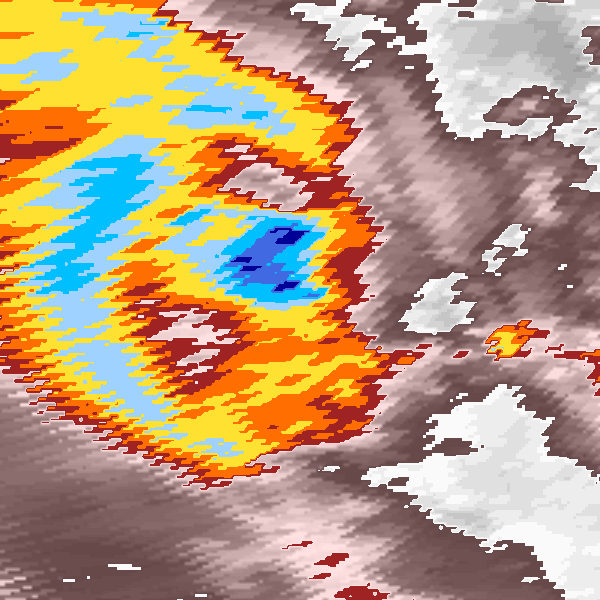
Moderate Tropical Storm HAJA (1984038S15434)
IBTrACS version v04r00. Visit
IBTrACS website for data access.
Please direct all questions to the
IBTrACS Q and A forum
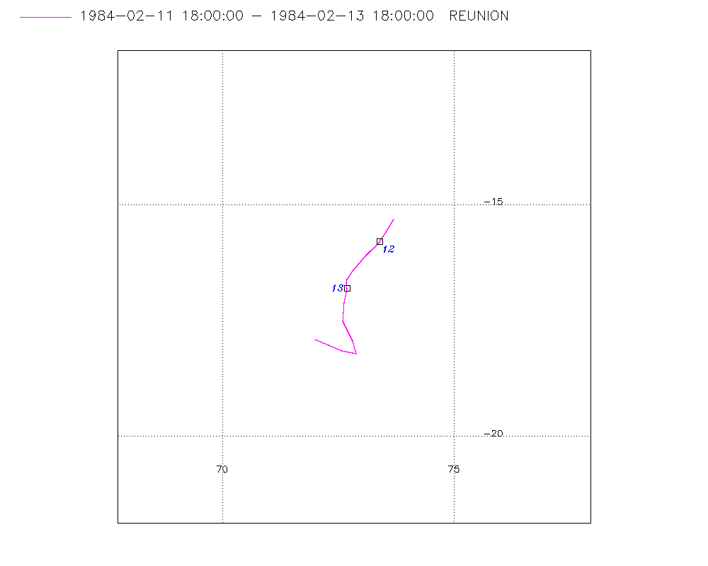
Storm track
-
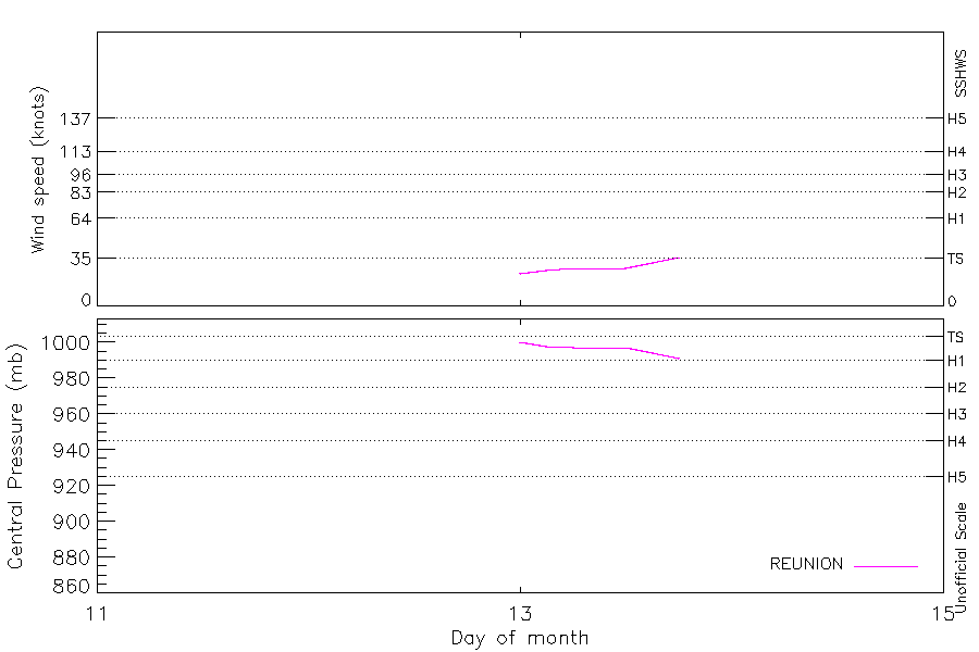
Intensity
-
Wind Radii
-
Intensity Data
-
Source Data
-
All data
Summary Information
Storm track plot
|
Intensity plots
|
Radial wind information
No radial wind information for this storm
|
Position and Intensity Table
Source Information
| Agency |
Information |
| USA |
|
| TOKYO |
|
| CMA |
|
| HKO |
|
| NEWDELHI |
|
| REUNION |
WMO-Best-Tracks.txt:Line=12829:haja |
| BOM |
|
| NADI |
|
| WELLINGTON |
|
| DS824 |
|
| TD9636 |
|
| TD9635 |
|
| NEUMANN |
|
| MLC |
|
All available IBTrACS Data
| SEASON |
BASIN |
SUBBASIN |
ISO_TIME_________ |
NATURE |
LAT |
LON |
WMO WIND |
WMO PRES |
WMO AGENCY |
DIST2LAND |
LANDFALL |
IFLAG |
USA SSHS |
REUNION LAT |
REUNION LON |
REUNION TYPE |
REUNION WIND |
REUNION PRES |
REUNION TNUM |
REUNION CI |
STORM SPEED |
STORM DIR |
| Year |
|
|
|
|
degrees north |
degrees east |
kts |
mb |
|
km |
km |
|
1 |
degrees north |
degrees east |
|
kts |
mb |
1 |
1 |
kts |
degrees |
| 1984 |
SI |
MM |
1984-02-11 18:00:00 |
TS |
-15.30 |
73.70 |
|
|
reunion |
1773 |
1751 |
_____O________ |
-5 |
-15.30 |
73.70 |
6 |
|
|
9.90 |
|
6 |
208 |
| 1984 |
SI |
MM |
21:00:00 |
TS |
-15.57 |
73.55 |
|
|
|
1751 |
1723 |
_____P________ |
-5 |
-15.58 |
73.54 |
6 |
|
|
|
|
6 |
210 |
| 1984 |
SI |
MM |
1984-02-12 00:00:00 |
TS |
-15.80 |
73.40 |
|
|
reunion |
1723 |
1709 |
_____O________ |
-5 |
-15.80 |
73.40 |
6 |
|
|
9.90 |
|
4 |
215 |
| 1984 |
SI |
MM |
03:00:00 |
TS |
-15.92 |
73.29 |
|
|
|
1709 |
1696 |
_____P________ |
-5 |
-15.92 |
73.29 |
6 |
|
|
|
|
3 |
224 |
| 1984 |
SI |
MM |
06:00:00 |
TS |
-16.00 |
73.20 |
|
|
reunion |
1696 |
1682 |
_____O________ |
-5 |
-16.00 |
73.20 |
6 |
|
|
9.90 |
|
2 |
228 |
| 1984 |
SI |
MM |
09:00:00 |
TS |
-16.08 |
73.11 |
|
|
|
1682 |
1668 |
_____P________ |
-5 |
-16.08 |
73.11 |
6 |
|
|
|
|
3 |
224 |
| 1984 |
SI |
MM |
12:00:00 |
TS |
-16.20 |
73.00 |
|
|
reunion |
1668 |
1641 |
_____O________ |
-5 |
-16.20 |
73.00 |
6 |
|
|
9.90 |
|
4 |
220 |
| 1984 |
SI |
MM |
15:00:00 |
TS |
-16.40 |
72.84 |
|
|
|
1641 |
1624 |
_____P________ |
-5 |
-16.40 |
72.84 |
6 |
|
|
|
|
5 |
216 |
| 1984 |
SI |
MM |
18:00:00 |
TS |
-16.60 |
72.70 |
|
|
reunion |
1624 |
1621 |
_____O________ |
-5 |
-16.60 |
72.70 |
6 |
|
|
9.90 |
|
3 |
207 |
| 1984 |
SI |
MM |
21:00:00 |
TS |
-16.68 |
72.68 |
|
|
|
1621 |
1618 |
_____P________ |
-5 |
-16.68 |
72.68 |
6 |
|
|
|
|
2 |
172 |
| 1984 |
SI |
MM |
1984-02-13 00:00:00 |
TS |
-16.80 |
72.70 |
24 |
1000 |
reunion |
1618 |
1598 |
_____O________ |
-5 |
-16.80 |
72.70 |
2 |
24 |
1000 |
2.00 |
2.00 |
4 |
188 |
| 1984 |
SI |
MM |
03:00:00 |
TS |
-17.11 |
72.63 |
|
|
|
1598 |
1587 |
_____P________ |
-5 |
-17.11 |
72.63 |
2 |
26 |
998 |
|
|
7 |
188 |
| 1984 |
SI |
MM |
06:00:00 |
TS |
-17.50 |
72.60 |
28 |
997 |
reunion |
1587 |
1584 |
_____O________ |
-5 |
-17.50 |
72.60 |
2 |
28 |
997 |
2.50 |
2.50 |
8 |
168 |
| 1984 |
SI |
MM |
09:00:00 |
TS |
-17.92 |
72.81 |
|
|
|
1598 |
1595 |
_____P________ |
-5 |
-17.92 |
72.81 |
2 |
28 |
997 |
|
|
8 |
158 |
| 1984 |
SI |
MM |
12:00:00 |
TS |
-18.20 |
72.90 |
28 |
997 |
reunion |
1601 |
1570 |
_____O________ |
-5 |
-18.20 |
72.90 |
2 |
28 |
997 |
2.50 |
2.50 |
3 |
234 |
| 1984 |
SI |
MM |
15:00:00 |
TS |
-18.12 |
72.53 |
|
|
|
1562 |
1515 |
_____P________ |
-5 |
-18.15 |
72.58 |
2 |
32 |
994 |
|
|
9 |
289 |
| 1984 |
SI |
MM |
18:00:00 |
TS |
-17.90 |
72.00 |
36 |
991 |
reunion |
1515 |
1476 |
_____O________ |
-5 |
-17.90 |
72.00 |
3 |
36 |
991 |
3.00 |
3.00 |
9 |
291 |
| 1984 |
SI |
MM |
21:00:00 |
TS |
-17.78 |
71.60 |
|
|
|
1476 |
|
______________ |
-5 |
|
|
3 |
|
|
|
|
8 |
287 |