1968
Severe Tropical Storm NADINE (1968208N24120)
IBTrACS version v04r00. Visit
IBTrACS website for data access.
Please direct all questions to the
IBTrACS Q and A forum
Storm track
-
Intensity
-
Wind Radii
-
Intensity Data
-
Source Data
-
All data
Summary Information
|
|
| Storm ID |
1968208N24120 |
| Start |
Jul 25 12Z |
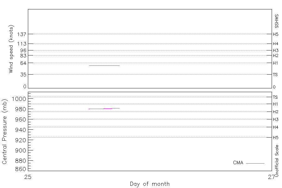
| Max Intensity |
58 kt (Jul 25 15Z) |
| End |
Jul 25 18Z |
| ATCF IDs |
|
| Track status |
Best track data. |
|
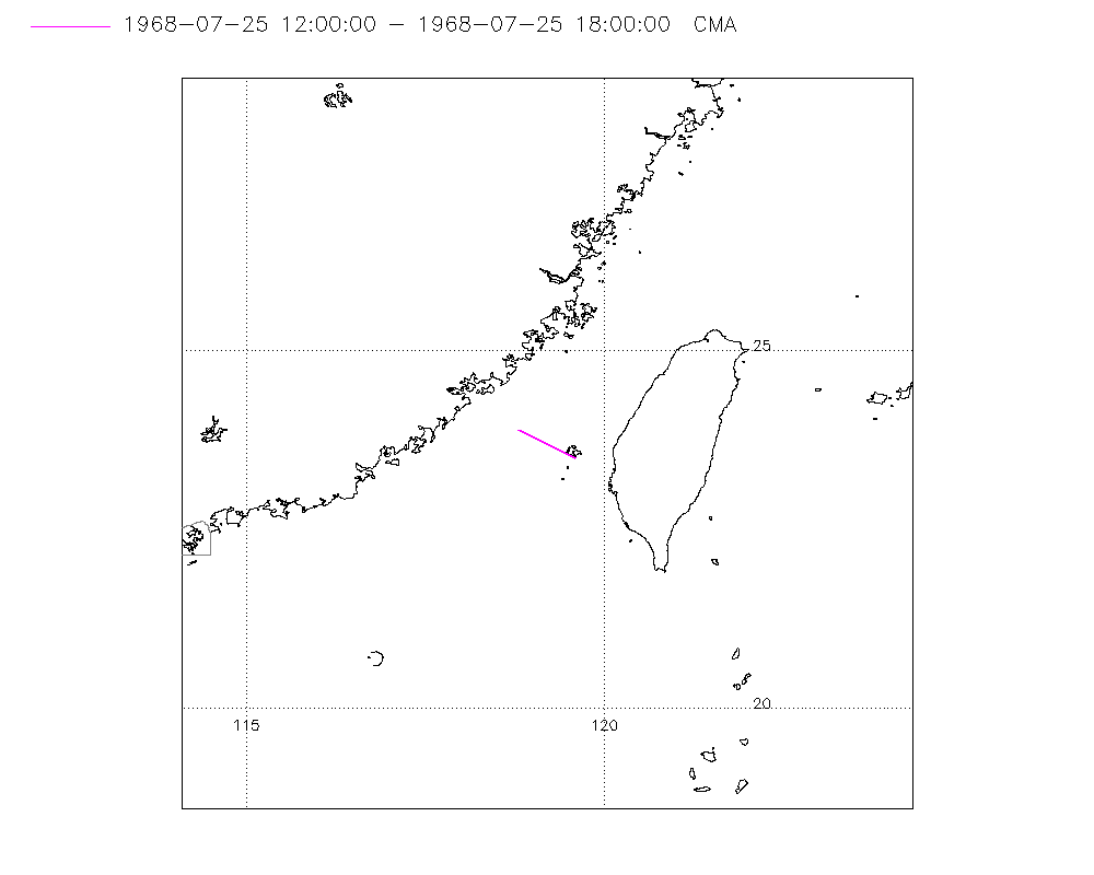
Storm track plot
|
Intensity plots
|
Radial wind information
No radial wind information for this storm
|
Position and Intensity Table
| BASIN |
ISO_TIME_________ |
NATURE |
LAT |
LON |
CMA WIND |
CMA PRES |
| |
|
|
degrees north |
degrees east |
kts |
mb |
| WP |
1968-07-25 12:00:00 |
TS |
23.50 |
119.60 |
58 |
980 |
| WP |
15:00:00 |
TS |
23.70 |
119.20 |
58 |
981 |
| WP |
18:00:00 |
TS |
23.90 |
118.80 |
58 |
982 |
Source Information
| Agency |
Information |
| USA |
|
| TOKYO |
|
| CMA |
CH1968BST.txt:Storm=9:Nadine(-)1 |
| HKO |
|
| NEWDELHI |
|
| REUNION |
|
| BOM |
|
| NADI |
|
| WELLINGTON |
|
| DS824 |
|
| TD9636 |
|
| TD9635 |
|
| NEUMANN |
|
| MLC |
|
All available IBTrACS Data
| SEASON |
BASIN |
SUBBASIN |
ISO_TIME_________ |
NATURE |
LAT |
LON |
DIST2LAND |
LANDFALL |
IFLAG |
USA SSHS |
CMA LAT |
CMA LON |
CMA CAT |
CMA WIND |
CMA PRES |
STORM SPEED |
STORM DIR |
| Year |
|
|
|
|
degrees north |
degrees east |
km |
km |
|
1 |
degrees north |
degrees east |
1 |
kts |
mb |
kts |
degrees |
| 1968 |
WP |
MM |
1968-07-25 12:00:00 |
TS |
23.50 |
119.60 |
52 |
52 |
__O___________ |
-5 |
23.50 |
119.60 |
3 |
58 |
980 |
8 |
299 |
| 1968 |
WP |
MM |
15:00:00 |
TS |
23.70 |
119.20 |
92 |
70 |
__P___________ |
-5 |
23.70 |
119.20 |
3 |
58 |
981 |
8 |
299 |
| 1968 |
WP |
MM |
18:00:00 |
TS |
23.90 |
118.80 |
70 |
|
__O___________ |
-5 |
23.90 |
118.80 |
3 |
58 |
982 |
8 |
299 |