1930
Tropical Depression NOT_NAMED (1930345S20048)
IBTrACS version v04r00. Visit
IBTrACS website for data access.
Please direct all questions to the
IBTrACS Q and A forum
Storm track
-
Intensity
-
Wind Radii
-
Intensity Data
-
Source Data
-
All data
Summary Information
|
|
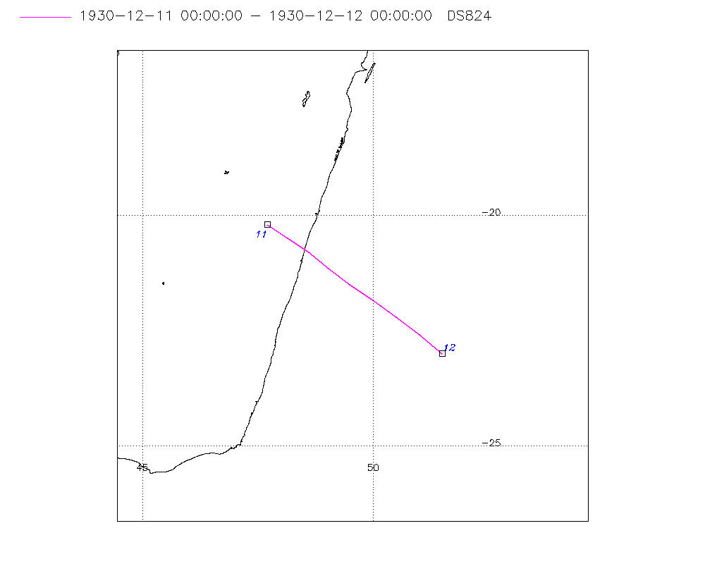
| Storm ID |
1930345S20048 |
| Start |
Dec 11 00Z |
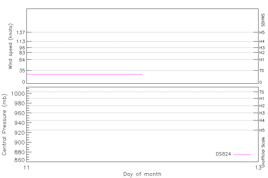
| Max Intensity |
25 kt (Dec 11 03Z) |
| End |
Dec 12 00Z |
| ATCF IDs |
|
| Track status |
Best track data. |
|
Storm track plot
|
Intensity plots
|
Radial wind information
No radial wind information for this storm
|
Position and Intensity Table
| BASIN |
ISO_TIME_________ |
NATURE |
LAT |
LON |
DS824 WIND |
| |
|
|
degrees north |
degrees east |
kts |
| SI |
1930-12-11 00:00:00 |
TS |
-20.20 |
47.70 |
25 |
| SI |
03:00:00 |
TS |
-20.49 |
48.15 |
25 |
| SI |
06:00:00 |
TS |
-20.80 |
48.60 |
25 |
| SI |
09:00:00 |
TS |
-21.14 |
49.04 |
25 |
| SI |
12:00:00 |
TS |
-21.50 |
49.50 |
25 |
| SI |
15:00:00 |
TS |
-21.84 |
49.99 |
25 |
| SI |
18:00:00 |
TS |
-22.20 |
50.50 |
25 |
| SI |
21:00:00 |
TS |
-22.59 |
51.00 |
25 |
| SI |
1930-12-12 00:00:00 |
TS |
-23.00 |
51.50 |
25 |
Source Information
| Agency |
Information |
| USA |
|
| TOKYO |
|
| CMA |
|
| HKO |
|
| NEWDELHI |
|
| REUNION |
|
| BOM |
|
| NADI |
|
| WELLINGTON |
|
| DS824 |
s_hem.dat:296:NOT NAMED |
| TD9636 |
|
| TD9635 |
|
| NEUMANN |
|
| MLC |
|
All available IBTrACS Data
| SEASON |
BASIN |
SUBBASIN |
ISO_TIME_________ |
NATURE |
LAT |
LON |
DIST2LAND |
LANDFALL |
IFLAG |
USA SSHS |
DS824 LAT |
DS824 LON |
DS824 STAGE |
DS824 WIND |
STORM SPEED |
STORM DIR |
| Year |
|
|
|
|
degrees north |
degrees east |
km |
km |
|
1 |
degrees north |
degrees east |
|
kts |
kts |
degrees |
| 1931 |
SI |
MM |
1930-12-11 00:00:00 |
TS |
-20.20 |
47.70 |
0 |
0 |
_________O____ |
-5 |
-20.20 |
47.70 |
TC |
25 |
10 |
124 |
| 1931 |
SI |
MM |
03:00:00 |
TS |
-20.49 |
48.15 |
0 |
0 |
_________P____ |
-5 |
-20.49 |
48.15 |
TC |
25 |
10 |
125 |
| 1931 |
SI |
MM |
06:00:00 |
TS |
-20.80 |
48.60 |
20 |
20 |
_________O____ |
-5 |
-20.80 |
48.60 |
TC |
25 |
11 |
128 |
| 1931 |
SI |
MM |
09:00:00 |
TS |
-21.14 |
49.04 |
63 |
63 |
_________P____ |
-5 |
-21.14 |
49.04 |
TC |
25 |
11 |
130 |
| 1931 |
SI |
MM |
12:00:00 |
TS |
-21.50 |
49.50 |
124 |
124 |
_________O____ |
-5 |
-21.50 |
49.50 |
TC |
25 |
11 |
128 |
| 1931 |
SI |
MM |
15:00:00 |
TS |
-21.84 |
49.99 |
181 |
181 |
_________P____ |
-5 |
-21.84 |
49.99 |
TC |
25 |
12 |
127 |
| 1931 |
SI |
MM |
18:00:00 |
TS |
-22.20 |
50.50 |
241 |
241 |
_________O____ |
-5 |
-22.20 |
50.50 |
TC |
25 |
12 |
129 |
| 1931 |
SI |
MM |
21:00:00 |
TS |
-22.59 |
51.00 |
301 |
301 |
_________P____ |
-5 |
-22.59 |
51.00 |
TC |
25 |
12 |
131 |
| 1931 |
SI |
MM |
1930-12-12 00:00:00 |
TS |
-23.00 |
51.50 |
364 |
|
_________O____ |
-5 |
-23.00 |
51.50 |
TC |
25 |
12 |
132 |